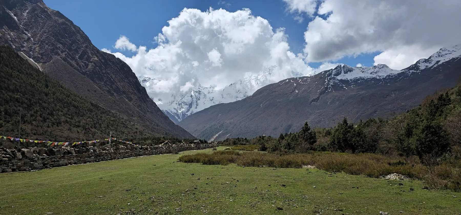
Photo: Nabin K. Sapkota · CC BY-SA 4.0 · Wikimedia Commons · resized; shared under the same licence
Manaslu Circuit + Tsum Valley
The full Manaslu Circuit, extended into the restricted Tsum valley
Manaslu Circuit + Tsum Valley links the classic circuit around Manaslu (8,163m) with a side-trip up the restricted Tsum valley to Mu Gompa (3,700m), a monastery near the Tibetan border, before rejoining the main trail to cross Larkya La (5,106m). At 18 days and rated hard, it is the longest of the Manaslu-region itineraries, and requires four separate permits — Manaslu and Tsum restricted-area permits alongside both conservation area permits.
Book Manaslu Circuit + Tsum Valley
No obligation. Or call +977-9849998031
Route map
Waypoints
- Day 1 — Soti Khola 730 m
- Day 2 — Machha Khola 870 m
- Day 3 — Jagat 1,340 m
- Day 4 — Lokpha 2,240 m
- Day 5 — Chumling 2,386 m
- Day 6 — Chhokangparo 3,031 m
- Day 7 — Nile 3,361 m
- Day 7 — Mu Gompa 3,700 m
- Day 8 — Chhokangparo 3,031 m
- Day 9 — Lokpha 2,240 m
- Day 10 — Deng 1,860 m
- Day 11 — Namrung 2,630 m
- Day 12 — Samagaun 3,530 m
- Day 13 — Samagaun 3,530 m
- Day 14 — Samdo 3,860 m
- Day 15 — Dharamsala 4,460 m
- Day 16 — Larkya La 5,106 m
- Day 16 — Bimthang 3,590 m
- Day 17 — Dharapani 1,860 m
Elevation profile
| Day | Place | Altitude | Gain from previous night |
|---|---|---|---|
| 1 | Soti Khola | 730 m | first night |
| 2 | Machha Khola | 870 m | +140 m |
| 3 | Jagat | 1,340 m | +470 m |
| 4 | Lokpha | 2,240 m | +900 m |
| 5 | Chumling | 2,386 m | +146 m |
| 6 | Chhokangparo | 3,031 m | +645 m |
| 7 | Mu Gompa | 3,700 m | +669 m |
| 8 | Chhokangparo | 3,031 m | -669 m |
| 9 | Lokpha | 2,240 m | -791 m |
| 10 | Deng | 1,860 m | -380 m |
| 11 | Namrung | 2,630 m | +770 m |
| 12 | Samagaun | 3,530 m | +900 m |
| 13 | Samagaun | 3,530 m | 0 m |
| 14 | Samdo | 3,860 m | +330 m |
| 15 | Dharamsala | 4,460 m | +600 m |
| 16 | Bimthang | 3,590 m | -870 m |
| 17 | Dharapani | 1,860 m | -1,730 m |
High points on this route that are not sleeping altitudes:
- Larkya La (day 16): 5,106 m
Terrain elevation interpolated between waypoints by SRTM30m — not the route's sourced altitudes. May read above or below maxAltitude/maxSleepAltitude (both cited, manual figures); render or label accordingly, do not treat as the same number.
Acclimatisation
4 nights on this itinerary gain more than 500 m of sleeping altitude: Chhokangparo (+645 m), Mu Gompa (+669 m), Samagaun (+900 m), Dharamsala (+600 m). Each of its 1 rest day follows the gain that earned it. The highest night is 4,460 m.
| Day | Sleeping at | Altitude | Gain from previous night | Rest day |
|---|---|---|---|---|
| 1 | Soti Khola | 730 m | first night | |
| 2 | Machha Khola | 870 m | +140 m | |
| 3 | Jagat | 1,340 m | +470 m | |
| 4 | Lokpha | 2,240 m | +900 m | |
| 5 | Chumling | 2,386 m | +146 m | |
| 6 | Chhokangparo | 3,031 m | +645 m (above the 500 m guideline) | |
| 7 | Mu Gompa | 3,700 m | +669 m (above the 500 m guideline) | |
| 8 | Chhokangparo | 3,031 m | -669 m | |
| 9 | Lokpha | 2,240 m | -791 m | |
| 10 | Deng | 1,860 m | -380 m | |
| 11 | Namrung | 2,630 m | +770 m | |
| 12 | Samagaun | 3,530 m | +900 m (above the 500 m guideline) | |
| 13 | Samagaun | 3,530 m | 0 m | Rest day — follows the gain above |
| 14 | Samdo | 3,860 m | +330 m | |
| 15 | Dharamsala | 4,460 m | +600 m (above the 500 m guideline) | |
| 16 | Bimthang | 3,590 m | -870 m | |
| 17 | Dharapani | 1,860 m | -1,730 m |
Cited to the Wilderness Medical Society Clinical Practice Guidelines (2024): above 3,000 m, do not increase sleeping elevation by more than 500 m per day, and take a rest day every 3–4 days. WMS itself notes that terrain often makes strict adherence impossible.
This is itinerary information, not medical advice, and not clearance to trek. Acclimatisation varies between individuals.
Your trip, day by day — all 18 days, travel included
Every day of the 18-day trip in the order it happens, including the flights, drives and rest days that have no walking stage. These are trip day numbers. The next section numbers walking days instead, starting again at 1, so a day number here and a walking day number there are not the same day.
- Day 1 of 18
Kathmandu — Arrival & Permits
Arrive in Kathmandu and go through the permit process for this combined itinerary — Manaslu and Tsum Valley restricted-area permits, plus the Manaslu and Annapurna conservation area permits, are all required before the drive out.
- Day 2 of 18
Kathmandu to Soti Khola (730m)
The drive out of Kathmandu winds through the hills of Gorkha district and down to Soti Khola (730m), the roadhead on the Budhi Gandaki where the trek itself begins.
- Day 3 of 18
Soti Khola to Machha Khola (870m)
The trail follows the Budhi Gandaki upstream through subtropical forest, alternating between river-level paths and climbs over rocky ridges, to the lodge village of Machha Khola (870m).
- Day 4 of 18
Machha Khola to Jagat (1,340m)
The gorge deepens and the trail crosses several suspension bridges on the way to Jagat (1,340m), the checkpoint where permits for the restricted area are first verified.
- Day 5 of 18
Jagat to Lokpha (2,240m)
The trail continues up the Budhi Gandaki before turning off the main Manaslu trail at Lokpha (2,240m), into the restricted Tsum side-valley.
- Day 6 of 18
Lokpha to Chumling (2,386m)
Into Tsum proper, the trail climbs to Chumling (2,386m), the valley's first village, set at the base of a large chorten.
- Day 7 of 18
Chumling to Chhokangparo (3,031m)
The trail continues up-valley to Chhokangparo (3,031m), the largest village in upper Tsum, its houses spread across the widening valley floor.
- Day 8 of 18
Chhokangparo to Mu Gompa (3,700m), via Nile (3,361m)
The trail passes through Nile (3,361m) before climbing on to Mu Gompa (3,700m), a working monastery founded in 1895 near the Tibetan border. This compressed itinerary sleeps at the monastery itself rather than basing at Nile for a day trip.
- Day 9 of 18
Monastery Morning at Mu Gompa — Descend to Chhokangparo (3,031m)
Time to explore Mu Gompa's monastery buildings before the trail descends back down the valley to Chhokangparo (3,031m) for the night.
- Day 10 of 18
Chhokangparo to Lokpha (2,240m)
Retrace the trail down the Tsum valley to Lokpha (2,240m), the junction where it rejoins the main Manaslu trail.
- Day 11 of 18
Lokpha to Deng (1,860m)
The trail descends to Deng (1,860m), at the confluence of two rivers and the entry point into the restricted Manaslu zone proper; permit checks begin here.
- Day 12 of 18
Deng to Namrung (2,630m)
The trail climbs through dense forest into the rain shadow of the range, the vegetation shifting from subtropical to temperate, on the way to Namrung (2,630m), a checkpoint village with the first real views of the Manaslu massif.
- Day 13 of 18
Namrung to Samagaun (3,530m)
Birch and pine forest gives way to open ground as the trail climbs to Samagaun (3,530m), a Tibetan trading village beneath the massive south face of Manaslu (8,163m).
- Day 14 of 18
Acclimatization Day in Samagaun (3,530m)
A second night at Samagaun for altitude adjustment before the push toward Larkya La.
- Day 15 of 18
Samagaun to Samdo (3,860m)
A shorter day to Samdo (3,860m), the last permanent village before the old trade route into Tibet, its landscape arid and wind-scoured.
- Day 16 of 18
Samdo to Dharamsala (4,460m)
The trail climbs to Dharamsala (4,460m), a single exposed lodge cluster on barren, glacial ground — the last stop before the pass.
- Day 17 of 18
Cross Larkya La (5,106m) — Descend to Bimthang (3,590m)
The trek's high point, crossed in a single long day over glacial moraine — nobody sleeps at the top. The descent on the far side reaches Bimthang (3,590m), a glacial meadow below Manaslu and Pungen.
- Day 18 of 18
Bimthang to Dharapani (1,860m)
The final trekking day descends through forest and terraced farmland to Dharapani (1,860m), where the trail meets the Annapurna Circuit and this itinerary ends.
Walking days on the mapped route — 17 days of sourced altitudes
Numbered by walking day: walking day 1 is the first day with a mapped stage. Every altitude below is a waypoint from this route's own sources, listed at the foot of the page.
- Soti Khola 730 m
overnight
Roadhead trailhead for the Manaslu Circuit; drive from Kathmandu. OSM carries it as place=isolated_dwelling, not village — the standard place=village|hamlet query returned nothing for it until the query was extended.
- Machha Khola 870 m
overnight
River-side lodge village on the Budi Gandaki; the road now sometimes reaches here directly, bypassing Soti Khola in some operators' itineraries.
- Jagat 1,340 m
overnight
Entry checkpoint. The resolver's nearest-to-region-centre pick for "Jagat" was a same-named, unrelated village roughly 50km away (id 295022614, wikidata-linked, ele=1300) — the exact failure mode this project's resolve-coords tooling is built to catch. The correct trailside Jagat (id 1078765998, no wikidata) sits 13.75km from Machha Khola and 14.47km from Deng, consistent with the sourced day-stage distances; the wrong candidate was rejected on that basis.
- Lokpha 2,240 m
overnight
The Tsum Valley turn-off — the route leaves the main Manaslu trail here and heads northeast into the restricted Tsum side-valley. Most trekking itineraries spell this "Lokpa"; OSM's hamlet node (confirmed by a duplicate way at the same location) carries the name "Lokpha".
- Chumling 2,386 m
overnight
First Tsum Valley village after the Lokpha turn-off, at the base of a large chorten.
- Chhokangparo 3,031 m
overnight
Largest village in upper Tsum, spread across the valley floor. Repointed (Phase 5 Task 5, Ruling F) from OSM node 8378384476 — named exactly "Chhokangparo" (wikidata Q103824266) but sitting ~9.5km up-valley at the head of the Tsum valley, past Nile and Mu Gompa; Wikipedia's coordinates (28.5830°N, 85.1156°E) matched that wrong node almost exactly, which is why it was kept originally. The correct village is OSM node 3480017509, "Chhokāng" (place=village, source=GNS), at 28.498026°N, 85.066411°E — this sits correctly between Chumling (28.474°N) and Nile (28.544°N) in the valley's south-to-north ascent, the structural evidence that settles it. The altitude, 3,031m, is unchanged and still the figure five independent trekking-operator itineraries give for the lodges trekkers actually overnight in (Wikipedia's own infobox states 3,501m for the wider administrative area, not the village centre). SRTM under the new point reads ~3,214m, a ~183m gap on steep ground — an ordinary SRTM/steep-ground divergence (see the known-SRTM-outliers list in tests/elevation-profile-alignment.test.ts), not a coordinate error: the old, wrong node's terrain read 3,659m against this same 3,031m, a ~628m gap that was the actual defect.
- Nile 3,361 m
day stop
Passed through on the way up to Mu Gompa; not slept at on this compressed 18-day itinerary, which sleeps directly at Mu Gompa instead.
- Mu Gompa 3,700 m
overnight
Highest and farthest point in Tsum Valley, a working monastery (est. 1895) near the Tibet border; a day trip from Nile, not slept at. OSM tags it place=isolated_dwelling + amenity=monastery under the name "Mu Gumba".
- Chhokangparo 3,031 m
overnight
Monastery exploration above Mu Gompa, then descent back to Chhokangparo to sleep.
- Lokpha 2,240 m
overnight
Retracing to the Tsum turn-off junction to rejoin the main Manaslu trail.
- Deng 1,860 m
overnight
Entry point to the restricted Manaslu zone; permit checks begin here.
- Namrung 2,630 m
overnight
First real Manaslu massif views; checkpoint village at the entrance to the upper valley.
- Samagaun 3,530 m
overnight
Acclimatization base below Manaslu (8,163m) itself; side trip to Manaslu Base Camp is optional and not modelled as a waypoint. OSM's node (Devanagari name, name:en="Samagaon") carries ele=3530 — an exact match to the published figure.
- Samagaun 3,530 m
overnight
Second night here — the acclimatization day before the push toward Larkya La.
- Samdo 3,860 m
overnight
Last permanent village before the Tibet border trade route; last reliable resupply before the Larkya La approach.
- Dharamsala 4,460 m
overnight
High camp (also spelled Dharmasala), the overnight before Larkya La — a single, exposed lodge cluster, not a village. The resolver's first candidate for "Dharmasala" (a tourism=camp_site node) sits 22km from Samdo, geographically implausible for a 4-5 hour trekking day; the correct node ("Larke Phedi - Dharmasala", place=village) sits 4.9km from Samdo and was used instead.
- Larkya La 5,106 m
day stop
The Circuit's high point, crossed in a single long day — not slept at. OSM's saddle node (name:en="Larkya La", wikidata-linked, mountain_pass=yes) carries ele=5106, an exact match to the published figure.
- Bimthang 3,590 m
overnight
First camp on the Annapurna Conservation Area side of the pass, in a glacial meadow below Pungen and Manaslu. OSM tags it place=isolated_dwelling.
- Dharapani 1,860 m
overnight
Rejoins the Annapurna Circuit trail; end of the Manaslu Circuit proper. OSM ele=1860 — an exact match to the published figure.
The remaining 1 day of this 18-day trip cover travel to and from the trailhead, and buffer time for delays en route — the specifics vary by route.
Permits
| Permit | Fee | Verified |
|---|---|---|
| Manaslu Restricted Area Permit | USD 100 | Verified 2026-09-07 |
| Tsum Valley Restricted Area Permit | USD 40 | Verified 2026-09-07 |
| Manaslu Conservation Area Permit | NPR 3,000 | Verified 2026-09-07 |
| Annapurna Conservation Area Permit | NPR 3,000 | Verified 2026-09-07 |
Cost breakdown
- Permits (NPR)
- NPR 6,000
- Permits (USD)
- USD 140
Permit fees above are the only figures on this page we have re-verified against the issuing authority; the route's itinerary and altitudes are built from the sources listed further down this page, not independently re-verified with one. Other trip costs — teahouse accommodation, a guide, a porter, and flights where the route requires one — vary by season, operator and party size and are not itemised here.
When to go
Month-by-month fit for Manaslu Circuit + Tsum Valley, based on this route's own best-months window.
- Jan avoid
- Feb shoulder
- Mar best
- Apr best
- May best
- Jun shoulder
- Jul avoid
- Aug avoid
- Sep shoulder
- Oct best
- Nov best
- Dec shoulder
Sources
- https://www.trekkingtoeverest.com/trip/manaslu-tsum-valley-trek/
- https://www.nepalhightrek.com/activities/manaslu-tsum-valley-trek/
- https://en.wikipedia.org/wiki/Larkya_La
- https://en.wikipedia.org/wiki/Chhokangparo
- https://www.himalayanrecreation.com/blog/manaslu-circuit-trek-permits-and-fees
- https://www.thirdrockadventures.com/blog/tsum-valley-trek-permits
Ready to book Manaslu Circuit + Tsum Valley?
18 days in the Manaslu region, highest night at 4,460 m, from USD 1,500.