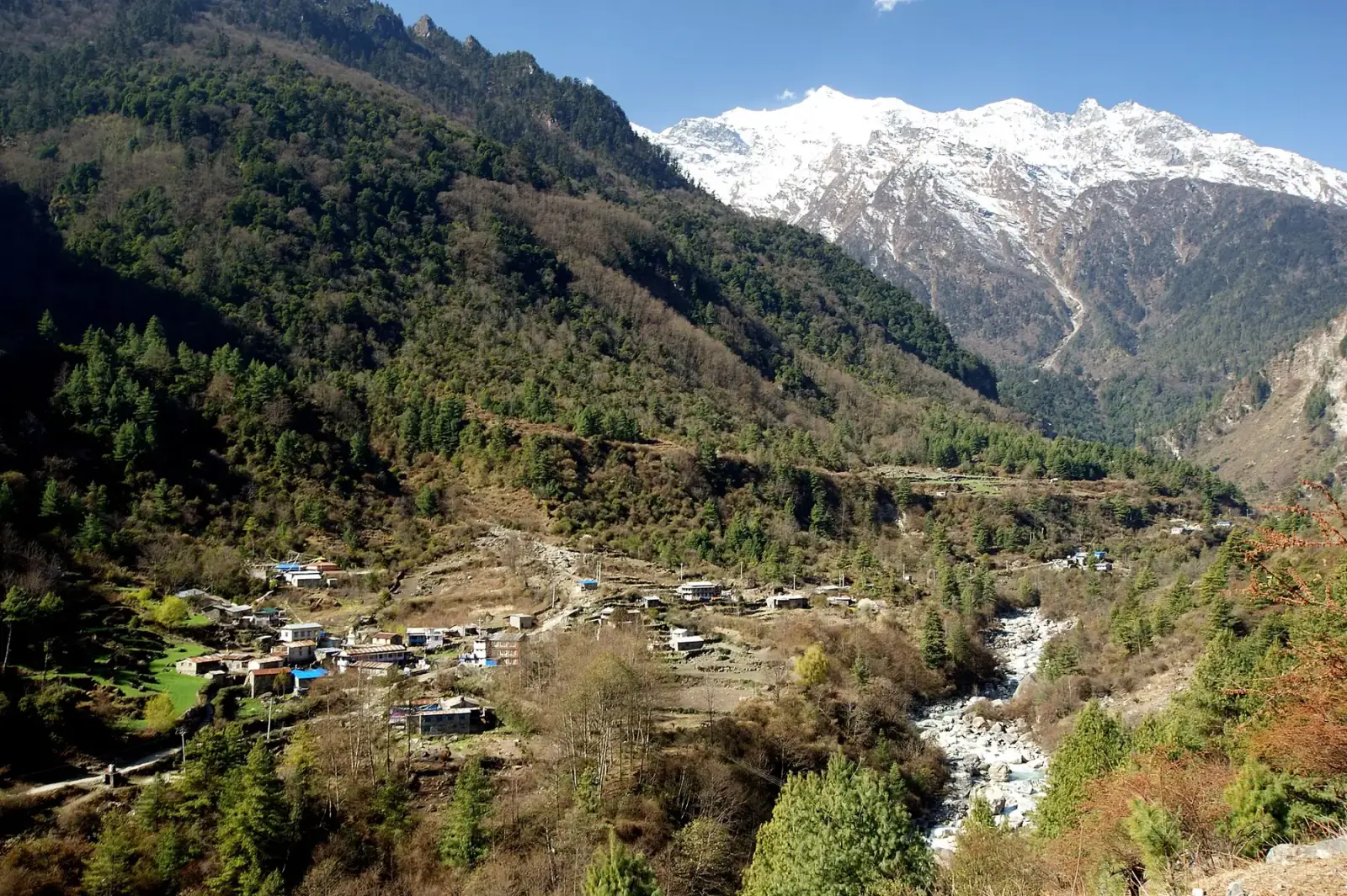
Photo: Kondephy · CC BY-SA 4.0 · Wikimedia Commons · resized; shared under the same licence
Annapurna Circuit
The world's greatest long-distance trek
The Annapurna Circuit is widely regarded as one of the finest long-distance treks on the planet. Over 18 days, you will circumnavigate the Annapurna massif, crossing the legendary Thorong La pass at 5,416 meters. The route passes through lush subtropical forests, arid Tibetan-influenced landscapes, terraced rice paddies, and high-altitude desert — an astonishing range of ecosystems in a single trek.
Book Annapurna Circuit
No obligation. Or call +977-9849998031
Route map
Waypoints
- Day 1 — Besisahar 760 m
- Day 1 — Bhulbhule 840 m
- Day 2 — Chamje 1,380 m
- Day 3 — Dharapani 1,860 m
- Day 4 — Bagarchap 2,160 m
- Day 5 — Chame 2,670 m
- Day 6 — Upper Pisang 3,300 m
- Day 7 — Ngawal 3,660 m
- Day 8 — Manang 3,540 m
- Day 9 — Manang 3,540 m
- Day 10 — Yak Kharka 4,018 m
- Day 11 — Thorong Phedi 4,540 m
- Day 12 — Thorong La 5,416 m
- Day 12 — Muktinath 3,762 m
- Day 13 — Jomsom 2,800 m
- Day 14 — Marpha 2,670 m
- Day 15 — Tatopani 1,190 m
- Day 16 — Ghorepani 2,850 m
- Day 17 — Poon Hill 3,210 m
- Day 17 — Tikhedhunga 1,480 m
- Day 18 — Birethanti 1,025 m
Map key
- Surveyed trail
- Follows the road — no separate trail mapped
Elevation profile
| Day | Place | Altitude | Gain from previous night |
|---|---|---|---|
| 1 | Bhulbhule | 840 m | first night |
| 2 | Chamje | 1,380 m | +540 m |
| 3 | Dharapani | 1,860 m | +480 m |
| 4 | Bagarchap | 2,160 m | +300 m |
| 5 | Chame | 2,670 m | +510 m |
| 6 | Upper Pisang | 3,300 m | +630 m |
| 7 | Ngawal | 3,660 m | +360 m |
| 8 | Manang | 3,540 m | -120 m |
| 9 | Manang | 3,540 m | 0 m |
| 10 | Yak Kharka | 4,018 m | +478 m |
| 11 | Thorong Phedi | 4,540 m | +522 m |
| 12 | Muktinath | 3,762 m | -778 m |
| 13 | Jomsom | 2,800 m | -962 m |
| 14 | Marpha | 2,670 m | -130 m |
| 15 | Tatopani | 1,190 m | -1,480 m |
| 16 | Ghorepani | 2,850 m | +1,660 m |
| 17 | Tikhedhunga | 1,480 m | -1,370 m |
| 18 | Birethanti | 1,025 m | -455 m |
High points on this route that are not sleeping altitudes:
- Thorong La (day 12): 5,416 m
Terrain elevation interpolated between waypoints by SRTM30m — not the route's sourced altitudes. May read above or below maxAltitude/maxSleepAltitude (both cited, manual figures); render or label accordingly, do not treat as the same number.
Acclimatisation
2 nights on this itinerary gain more than 500 m of sleeping altitude: Upper Pisang (+630 m), Thorong Phedi (+522 m). 0 of its 1 rest days follow the largest gains. The highest night is 4,540 m.
| Day | Sleeping at | Altitude | Gain from previous night | Rest day |
|---|---|---|---|---|
| 1 | Bhulbhule | 840 m | first night | |
| 2 | Chamje | 1,380 m | +540 m | |
| 3 | Dharapani | 1,860 m | +480 m | |
| 4 | Bagarchap | 2,160 m | +300 m | |
| 5 | Chame | 2,670 m | +510 m | |
| 6 | Upper Pisang | 3,300 m | +630 m (above the 500 m guideline) | |
| 7 | Ngawal | 3,660 m | +360 m | |
| 8 | Manang | 3,540 m | -120 m | |
| 9 | Manang | 3,540 m | 0 m | Rest day |
| 10 | Yak Kharka | 4,018 m | +478 m | |
| 11 | Thorong Phedi | 4,540 m | +522 m (above the 500 m guideline) | |
| 12 | Muktinath | 3,762 m | -778 m | |
| 13 | Jomsom | 2,800 m | -962 m | |
| 14 | Marpha | 2,670 m | -130 m | |
| 15 | Tatopani | 1,190 m | -1,480 m | |
| 16 | Ghorepani | 2,850 m | +1,660 m | |
| 17 | Tikhedhunga | 1,480 m | -1,370 m | |
| 18 | Birethanti | 1,025 m | -455 m |
Cited to the Wilderness Medical Society Clinical Practice Guidelines (2024): above 3,000 m, do not increase sleeping elevation by more than 500 m per day, and take a rest day every 3–4 days. WMS itself notes that terrain often makes strict adherence impossible.
This is itinerary information, not medical advice, and not clearance to trek. Acclimatisation varies between individuals.
Your trip, day by day — all 18 days, travel included
Every day of the 18-day trip in the order it happens, including the flights, drives and rest days that have no walking stage. These are trip day numbers. The next section numbers walking days instead, starting again at 1, so a day number here and a walking day number there are not the same day.
- Day 1 of 18
Kathmandu — Arrival & Orientation
Arrive in Kathmandu and join the group for an orientation briefing. Meet your lead guide and assistant guides, review the itinerary, check permits, and prepare for the journey ahead.
- Day 2 of 18
Drive to Besisahar — Trek to Bhulbhule
Early morning drive from Kathmandu to Besisahar (760m), the traditional starting point of the circuit. Begin trekking through rice paddies and subtropical forest to Bhulbhule (840m).
- Day 3 of 18
Bhulbhule to Chamje
Follow the Marsyangdi River valley northward. The trail passes through Bahundanda and several small villages, crossing suspension bridges and climbing gentle gradients to Chamje (1,380m).
- Day 4 of 18
Chamje to Bagarchap
The landscape begins to change as you gain altitude. Trek through waterfalls and dramatic gorges to Bagarchap (2,160m), where Tibetan Buddhist culture starts to become visible in the architecture and prayer flags.
- Day 5 of 18
Bagarchap to Chame
Continue ascending through pine and fir forests to Chame (2,670m), the administrative headquarters of the Manang district. Hot springs nearby offer a welcome soak for tired muscles.
- Day 6 of 18
Chame to Upper Pisang
Trek through a deep forest with spectacular views of Annapurna II. Arrive at Upper Pisang (3,300m), a traditional Tibetan-style village with a centuries-old monastery perched above the rooftops.
- Day 7 of 18
Upper Pisang to Manang
The trail opens into the broad Manang Valley, one of the most dramatic landscapes on the circuit. Arrive at Manang (3,540m), a bustling trade village that serves as the last major settlement before the high pass.
- Day 8 of 18
Acclimatization Day in Manang
Essential rest day for altitude adjustment. Optional hike to Gangapurna Lake or the Ice Lake above Braga village. The views of Annapurna III and Gangapurna from Manang are extraordinary.
- Day 9 of 18
Manang to Yak Kharka
Leave Manang and climb steadily to Yak Kharka (4,018m). The vegetation thins to scrub and the air becomes noticeably drier. Yak herders graze their animals in the surrounding meadows.
- Day 10 of 18
Yak Kharka to Thorong Phedi
Trek to Thorong Phedi (4,540m), the base camp for the Thorong La pass crossing. An early dinner and early sleep prepare you for the biggest day of the trek tomorrow.
- Day 11 of 18
Cross Thorong La (5,416m) — Descend to Muktinath
The defining day of the circuit. Depart before dawn for the climb to Thorong La (5,416m), the highest point of the trek. Prayer flags mark the pass. Descend steeply to the sacred temple town of Muktinath (3,762m) on the other side.
- Day 12 of 18
Muktinath to Jomsom
Descend through the arid Kali Gandaki Valley, the deepest gorge in the world. The landscape is stark and beautiful — a complete contrast to the lush forests of the first week. Arrive in Jomsom (2,800m).
- Day 13 of 18
Jomsom to Tatopani
Continue descending along the Kali Gandaki. The apple orchards of Marpha and the medieval village of Tukuche are highlights. Soak in the natural hot springs at Tatopani (1,190m) — a well-earned reward.
- Day 14 of 18
Tatopani to Ghorepani
A big climb day, ascending from the valley floor through terraced hillsides and rhododendron forests to Ghorepani (2,850m). The effort is worth it for what comes tomorrow morning.
- Day 15 of 18
Poon Hill Sunrise — Trek to Tikhedhunga
Pre-dawn hike to Poon Hill (3,210m) for a legendary sunrise panorama spanning Dhaulagiri, Annapurna South, Machhapuchhre (Fishtail), and the entire Annapurna range. Descend through rhododendron and oak forest and the long stone staircase past Ulleri to Tikhedhunga (1,480m).
- Day 16 of 18
Tikhedhunga to Birethanti
Follow the Modi Khola downstream through terraced farmland and Magar villages to Birethanti (1,025m), where the trail meets the road to Nayapul.
- Day 17 of 18
Birethanti to Nayapul — Drive to Pokhara
Final trekking day. A short walk along the river to the roadhead at Nayapul, then drive to the lakeside city of Pokhara. Celebrate the completion of the circuit with the team over a lakeside dinner.
- Day 18 of 18
Pokhara to Kathmandu — Departure
Morning flight or drive to Kathmandu. Free time for last-minute shopping or sightseeing. Transfer to the airport for departure, or extend your stay to explore more of Nepal.
Walking days on the mapped route — 18 days of sourced altitudes
Numbered by walking day: walking day 1 is the first day with a mapped stage. Every altitude below is a waypoint from this route's own sources, listed at the foot of the page.
- Besisahar 760 m
day stop
Roadhead where the drive from Kathmandu ends and the trek begins; not overnighted — the group treks on to Bhulbhule the same day. OSM node 293621413 (place=town) carries ele=760, an exact match to the published figure. Also named as a drive destination (no altitude given) in manaslu-circuit's day-13 prose, where the two routes' trailheads converge — not modelled there since no figure is quoted.
- Bhulbhule 840 m
overnight
First night on the trek proper. OSM node 293642180 (place=village, name:en="Bhulbhule") carries ele=840, an exact match to the published figure.
- Chamje 1,380 m
overnight
River-gorge village on the Marsyangdi. OSM carries two candidates at this location: a hamlet node (5839896129) with no ele tag, and a way (340851671, place=village, landuse=residential) with ele=1380 — used here. 50m below the 1,430m figure some trekking-guide itineraries quote; no in-repo source corroborates 1,430m, so the OSM-sourced figure is published.
- Dharapani 1,860 m
overnight
Drive from Besisahar via Bhulbhule, Jagat, Chamje and Tal (unresolved in OSM at this scale; passed en route, not modelled as separate waypoints). Permit check post. Coordinate corrected during the Task 9 audit: the annapurna-region cache's only "Dharapani" node (28.2820199, 83.8340827, no ele tag) is an unrelated, same-named village roughly 65km southwest of the real trailhead — the resolver had no other candidate to pick from in this region's cache and both the original author and a first resolver pass missed it because there was no name-based disagreement to catch, only a chain-distance one. The real Manang-district Dharapani (28.5189984, 84.3583825) is the node manaslu-circuit/manaslu-tsum already use correctly — OSM ele=1860 there is an exact match to this waypoint's own published altitude.
- Bagarchap 2,160 m
overnight
Between Dharapani and Chame, where Tibetan Buddhist architecture becomes visible. OSM node 295044653 carries name="Bagarchhāp" with alt_name="Bagarchap" (the spelling used here, matching the published prose) and ele=2160 — an exact match to the published figure.
- Chame 2,670 m
overnight
District headquarters of Manang. Via Timang and Thanchok.
- Upper Pisang 3,300 m
overnight
Via Bhratang and Dhukur Pokhari.
- Ngawal 3,660 m
overnight
The high route via Ghyaru — climbs above Manang before dropping into it, adding acclimatization exposure on purpose.
- Manang 3,540 m
overnight
Net descent from Ngawal into the valley floor.
- Manang 3,540 m
overnight
Acclimatization day. Optional side hikes to Gangapurna Lake or Ice Lake.
- Yak Kharka 4,018 m
overnight
Beyond the tree line. Via Ghunsang.
- Thorong Phedi 4,540 m
overnight
Staging point below Thorong La. Some parties push on to High Camp (~4,800m) instead.
- Thorong La 5,416 m
day stop
The high point of the Circuit. Crossed, not slept at — a pre-dawn start and 7-8 hours to clear it safely.
- Muktinath 3,762 m
overnight
Descent of over 1,600m the same day. The sacred temple itself — 108 water spouts, revered by both Hindus and Buddhists. Altitude from Wikipedia. Trekkers overnight at Ranipauwa, the lodge village immediately below the temple, not at the temple itself.
- Jomsom 2,800 m
overnight
Mustang district headquarters, in the Kali Gandaki gorge.
- Marpha 2,670 m
overnight
Apple-growing village, between Jomsom and Tatopani.
- Tatopani 1,190 m
overnight
Hot springs. Some itineraries cover this stretch partly by jeep on the Kali Gandaki road.
- Ghorepani 2,850 m
overnight
Via Sikha.
- Poon Hill 3,210 m
day stop
Pre-dawn viewpoint above Ghorepani. Day objective, not an overnight — same principle as Thorong La.
- Tikhedhunga 1,480 m
overnight
Descent via Ulleri (~3,000 stone steps).
- Birethanti 1,025 m
overnight
Roadhead near Nayapul. Jeep/bus to Pokhara.
Permits
| Permit | Fee | Verified |
|---|---|---|
| Annapurna Conservation Area Permit | NPR 3,000 | Verified 2026-09-07 |
Cost breakdown
- Permits (NPR)
- NPR 3,000
Permit fees above are the only figures on this page we have re-verified against the issuing authority; the route's itinerary and altitudes are built from the sources listed further down this page, not independently re-verified with one. Other trip costs — teahouse accommodation, a guide, a porter, and flights where the route requires one — vary by season, operator and party size and are not itemised here.
When to go
Month-by-month fit for Annapurna Circuit, based on this route's own best-months window.
- Jan avoid
- Feb shoulder
- Mar best
- Apr best
- May best
- Jun shoulder
- Jul avoid
- Aug shoulder
- Sep best
- Oct best
- Nov best
- Dec shoulder
Annapurna Circuit — Frequently Asked Questions
How difficult is the Annapurna Circuit?
When is the best time to do the Annapurna Circuit?
How crowded is the Annapurna Circuit?
Can I do the circuit clockwise instead?
What about the road construction on the circuit?
Sources
Ready to book Annapurna Circuit?
18 days in the Annapurna region, highest night at 4,540 m, from USD 1,400.