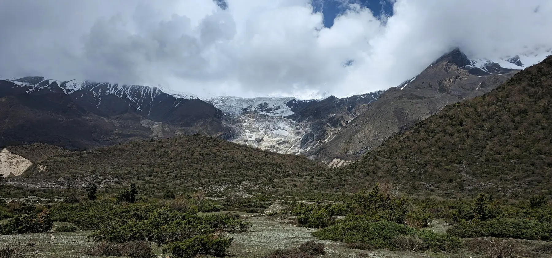
Photo: Nabin K. Sapkota · CC BY-SA 4.0 · Wikimedia Commons · resized; shared under the same licence
Manaslu Circuit
Nepal's best-kept secret — raw Himalayan beauty, fewer crowds
The Manaslu Circuit trek is the finest restricted-area trek in Nepal. Over 14 days, you will circumnavigate Manaslu (8,163m), the world's eighth-highest mountain, crossing the dramatic Larkya La pass at 5,106 meters. This trek requires a special restricted area permit and a minimum group size of two, which keeps trekker numbers low and the experience authentic. The route passes through diverse landscapes — subtropical forests, terraced hillsides, Buddhist monasteries, and high-altitude glacial terrain — with a fraction of the foot traffic of Annapurna or Everest.
Book Manaslu Circuit
No obligation. Or call +977-9849998031
Route map
Waypoints
- Day 1 — Soti Khola 730 m
- Day 2 — Machha Khola 870 m
- Day 3 — Jagat 1,340 m
- Day 4 — Deng 1,860 m
- Day 5 — Namrung 2,630 m
- Day 6 — Lho 3,180 m
- Day 7 — Samagaun 3,530 m
- Day 8 — Samagaun 3,530 m
- Day 9 — Samdo 3,860 m
- Day 10 — Dharamsala 4,460 m
- Day 11 — Larkya La 5,106 m
- Day 11 — Bimthang 3,590 m
- Day 12 — Tilche 2,300 m
- Day 13 — Dharapani 1,860 m
Elevation profile
| Day | Place | Altitude | Gain from previous night |
|---|---|---|---|
| 1 | Soti Khola | 730 m | first night |
| 2 | Machha Khola | 870 m | +140 m |
| 3 | Jagat | 1,340 m | +470 m |
| 4 | Deng | 1,860 m | +520 m |
| 5 | Namrung | 2,630 m | +770 m |
| 6 | Lho | 3,180 m | +550 m |
| 7 | Samagaun | 3,530 m | +350 m |
| 8 | Samagaun | 3,530 m | 0 m |
| 9 | Samdo | 3,860 m | +330 m |
| 10 | Dharamsala | 4,460 m | +600 m |
| 11 | Bimthang | 3,590 m | -870 m |
| 12 | Tilche | 2,300 m | -1,290 m |
| 13 | Dharapani | 1,860 m | -440 m |
High points on this route that are not sleeping altitudes:
- Larkya La (day 11): 5,106 m
Terrain elevation interpolated between waypoints by SRTM30m — not the route's sourced altitudes. May read above or below maxAltitude/maxSleepAltitude (both cited, manual figures); render or label accordingly, do not treat as the same number.
Acclimatisation
2 nights on this itinerary gain more than 500 m of sleeping altitude: Lho (+550 m), Dharamsala (+600 m). 0 of its 1 rest days follow the largest gains. The highest night is 4,460 m.
| Day | Sleeping at | Altitude | Gain from previous night | Rest day |
|---|---|---|---|---|
| 1 | Soti Khola | 730 m | first night | |
| 2 | Machha Khola | 870 m | +140 m | |
| 3 | Jagat | 1,340 m | +470 m | |
| 4 | Deng | 1,860 m | +520 m | |
| 5 | Namrung | 2,630 m | +770 m | |
| 6 | Lho | 3,180 m | +550 m (above the 500 m guideline) | |
| 7 | Samagaun | 3,530 m | +350 m | |
| 8 | Samagaun | 3,530 m | 0 m | Rest day |
| 9 | Samdo | 3,860 m | +330 m | |
| 10 | Dharamsala | 4,460 m | +600 m (above the 500 m guideline) | |
| 11 | Bimthang | 3,590 m | -870 m | |
| 12 | Tilche | 2,300 m | -1,290 m | |
| 13 | Dharapani | 1,860 m | -440 m |
Cited to the Wilderness Medical Society Clinical Practice Guidelines (2024): above 3,000 m, do not increase sleeping elevation by more than 500 m per day, and take a rest day every 3–4 days. WMS itself notes that terrain often makes strict adherence impossible.
This is itinerary information, not medical advice, and not clearance to trek. Acclimatisation varies between individuals.
Your trip, day by day — all 14 days, travel included
Every day of the 14-day trip in the order it happens, including the flights, drives and rest days that have no walking stage. These are trip day numbers. The next section numbers walking days instead, starting again at 1, so a day number here and a walking day number there are not the same day.
- Day 1 of 14
Kathmandu — Arrival & Briefing
Arrive in Kathmandu. Group orientation, permit check, and gear review. The restricted area permit and Manaslu Conservation Area Permit have been arranged in advance. Briefing dinner with your guide and team.
- Day 2 of 14
Kathmandu to Soti Khola (730m)
Drive from Kathmandu to Arughat (7-8 hours), then continue to Soti Khola. The drive passes through the hills of Gorkha district, offering a glimpse of rural Nepal. Overnight in a basic lodge by the Budhi Gandaki river.
- Day 3 of 14
Soti Khola to Machha Khola (870m)
Trek along the Budhi Gandaki river gorge through subtropical forest. The trail alternates between river-level paths and climbs over rocky ridges. Waterfalls cascade from the cliffs above. Walking time: 6-7 hours.
- Day 4 of 14
Machha Khola to Jagat (1,340m)
Continue through the deepening gorge. Cross suspension bridges and pass through small villages. The trail is rugged and beautiful. Enter the Manaslu Conservation Area at Jagat, where the checkpoint verifies permits. Walking time: 6-7 hours.
- Day 5 of 14
Jagat to Deng (1,860m)
The valley narrows dramatically. Pass through Philim, a Gurung village with terraced fields, and descend to Deng at the confluence of two rivers. The landscape begins to show Tibetan influence. Walking time: 6-7 hours.
- Day 6 of 14
Deng to Namrung (2,630m)
Ascend through dense forest into the rain shadow of the Himalayas. The vegetation shifts from subtropical to temperate. Pass mani walls and prayer wheels as Tibetan Buddhist culture becomes dominant. Walking time: 6-7 hours.
- Day 7 of 14
Namrung to Samagaun (3,530m)
Trek through birch and pine forests with views of Manaslu growing more dominant. Arrive at Samagaun, a prosperous Tibetan trading village at the base of Manaslu. Views of the mountain's massive south face from the village are extraordinary. Walking time: 6-7 hours.
- Day 8 of 14
Acclimatization Day in Samagaun
Rest day for altitude adjustment. Optional hike to Birendra Lake at the foot of the Manaslu Glacier, or explore the ancient Pungyen Gompa monastery above the village. Your guide monitors acclimatization progress.
- Day 9 of 14
Samagaun to Samdo (3,860m)
Short trek to the remote village of Samdo, near the Tibetan border. This area was historically a trading post with Tibet. The landscape is arid and wind-swept, with views of Manaslu North. Walking time: 3-4 hours.
- Day 10 of 14
Samdo to Dharamsala (4,460m)
Climb to Dharamsala, a collection of basic stone shelters. The terrain is barren and glacial. An early dinner and sleep prepare you for the pass crossing. Walking time: 4-5 hours.
- Day 11 of 14
Cross Larkya La (5,106m) — Descend to Bimthang (3,590m)
The crux day. Depart before dawn for the climb to Larkya La (5,106m). The ascent crosses glacial moraine with views of Cho Danda and Larkya Peak. Prayer flags mark the pass. A long, steep descent on the other side leads to the meadows of Bimthang with dramatic Manaslu views. Walking time: 8-10 hours.
- Day 12 of 14
Bimthang to Tilche (2,300m)
Descend through pine forests and past terraced farmland. The landscape transforms from alpine to lush and green. You rejoin the Marsyangdi River valley — the same river system as the Annapurna Circuit. Walking time: 5-6 hours.
- Day 13 of 14
Tilche to Dharapani — Drive to Besisahar
Final trekking section to Dharapani (1,860m), where the Manaslu Circuit meets the Annapurna Circuit trail. Drive to Besisahar and continue to Kathmandu or overnight en route. Walking time: 3-4 hours plus driving.
- Day 14 of 14
Return to Kathmandu — Departure
Arrive in Kathmandu (if not already). Free day for sightseeing, shopping in Thamel, or visiting Kathmandu Valley temples. Farewell dinner and certificate presentation. Airport transfer for departure.
Walking days on the mapped route — 13 days of sourced altitudes
Numbered by walking day: walking day 1 is the first day with a mapped stage. Every altitude below is a waypoint from this route's own sources, listed at the foot of the page.
- Soti Khola 730 m
overnight
Roadhead trailhead for the Manaslu Circuit; drive from Kathmandu. OSM carries it as place=isolated_dwelling, not village — the standard place=village|hamlet query returned nothing for it until the query was extended.
- Machha Khola 870 m
overnight
River-side lodge village on the Budi Gandaki; the road now sometimes reaches here directly, bypassing Soti Khola in some operators' itineraries.
- Jagat 1,340 m
overnight
Entry checkpoint. The resolver's nearest-to-region-centre pick for "Jagat" was a same-named, unrelated village roughly 50km away (id 295022614, wikidata-linked, ele=1300) — the exact failure mode this project's resolve-coords tooling is built to catch. The correct trailside Jagat (id 1078765998, no wikidata) sits 13.75km from Machha Khola and 14.47km from Deng, consistent with the sourced day-stage distances; the wrong candidate was rejected on that basis.
- Deng 1,860 m
overnight
Entry point to the restricted Manaslu zone; permit checks begin here.
- Namrung 2,630 m
overnight
First real Manaslu massif views; checkpoint village at the entrance to the upper valley.
- Lho 3,180 m
overnight
Mani walls and Ribung Gompa above the village; OSM ele=3170m, 10m from the published 3,180m — within this project's normal source-disagreement range.
- Samagaun 3,530 m
overnight
Acclimatization base below Manaslu (8,163m) itself; side trip to Manaslu Base Camp is optional and not modelled as a waypoint. OSM's node (Devanagari name, name:en="Samagaon") carries ele=3530 — an exact match to the published figure.
- Samagaun 3,530 m
overnight
Second night here — the acclimatization day, with an optional excursion toward Manaslu Base Camp not modelled as a separate waypoint.
- Samdo 3,860 m
overnight
Last permanent village before the Tibet border trade route; last reliable resupply before the Larkya La approach.
- Dharamsala 4,460 m
overnight
High camp (also spelled Dharmasala), the overnight before Larkya La — a single, exposed lodge cluster, not a village. The resolver's first candidate for "Dharmasala" (a tourism=camp_site node) sits 22km from Samdo, geographically implausible for a 4-5 hour trekking day; the correct node ("Larke Phedi - Dharmasala", place=village) sits 4.9km from Samdo and was used instead.
- Larkya La 5,106 m
day stop
The Circuit's high point, crossed in a single long day — not slept at. OSM's saddle node (name:en="Larkya La", wikidata-linked, mountain_pass=yes) carries ele=5106, an exact match to the published figure.
- Bimthang 3,590 m
overnight
First camp on the Annapurna Conservation Area side of the pass, in a glacial meadow below Pungen and Manaslu. OSM tags it place=isolated_dwelling.
- Tilche 2,300 m
overnight
Descent village on the west side; most trekking itineraries spell this "Tilije"/"Tilje", but OSM's node (ele=2260, 40m from the published 2,300m figure) carries the name "Tilche".
- Dharapani 1,860 m
overnight
Rejoins the Annapurna Circuit trail; end of the Manaslu Circuit proper. OSM ele=1860 — an exact match to the published figure.
The remaining 1 day of this 14-day trip cover travel to and from the trailhead, and buffer time for delays en route — the specifics vary by route.
Permits
| Permit | Fee | Verified |
|---|---|---|
| Manaslu Restricted Area Permit | USD 100 | Verified 2026-09-07 |
| Manaslu Conservation Area Permit | NPR 3,000 | Verified 2026-09-07 |
| Annapurna Conservation Area Permit | NPR 3,000 | Verified 2026-09-07 |
Cost breakdown
- Permits (NPR)
- NPR 6,000
- Permits (USD)
- USD 100
Permit fees above are the only figures on this page we have re-verified against the issuing authority; the route's itinerary and altitudes are built from the sources listed further down this page, not independently re-verified with one. Other trip costs — teahouse accommodation, a guide, a porter, and flights where the route requires one — vary by season, operator and party size and are not itemised here.
When to go
Month-by-month fit for Manaslu Circuit, based on this route's own best-months window.
- Jan avoid
- Feb shoulder
- Mar best
- Apr best
- May best
- Jun shoulder
- Jul avoid
- Aug avoid
- Sep shoulder
- Oct best
- Nov best
- Dec shoulder
Manaslu Circuit — Frequently Asked Questions
Why does Manaslu require a restricted area permit?
How does Manaslu compare to the Annapurna Circuit?
How hard is the Larkya La pass crossing?
What is the best season for the Manaslu Circuit?
Is the Manaslu trek suitable for beginners?
Sources
- https://en.wikipedia.org/wiki/Larkya_La
- https://sherpaexpeditiontrekking.com/blog/manaslu-circuit-trek-14-days-itinerary
- https://www.nepalhightrek.com/activities/manaslu-circuit-trek/
- https://outfitternepal.com/trip/manaslu-circuit-trek
- https://www.himalayanrecreation.com/blog/manaslu-circuit-trek-permits-and-fees
- https://viewnepaltreks.com/blog/manaslu-circuit-trek-permits-rap-mcap-acap-explained
Ready to book Manaslu Circuit?
14 days in the Manaslu region, highest night at 4,460 m, from USD 1,200.