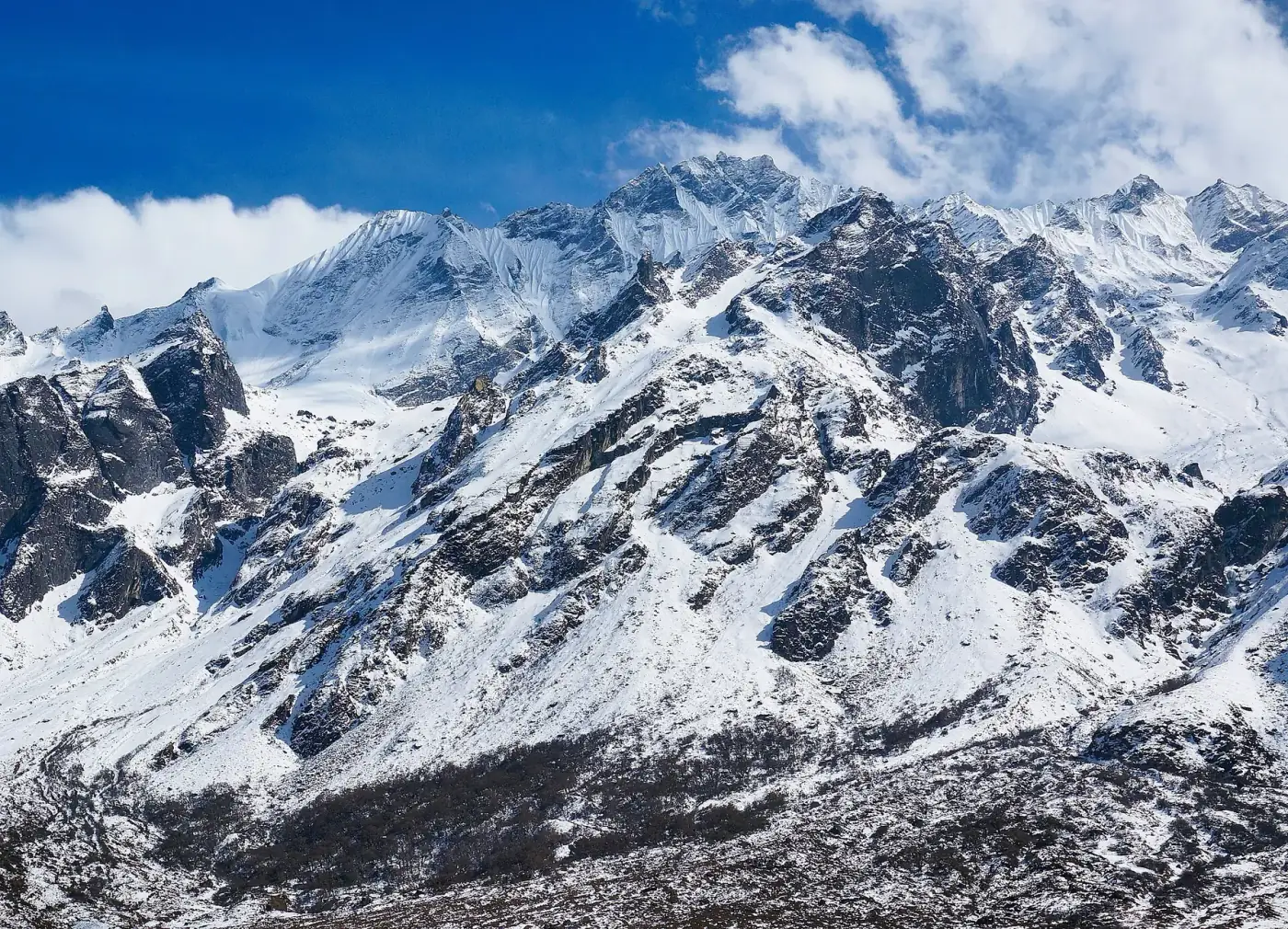
Photo: Andrew and Annemarie · CC BY-SA 2.0 · Wikimedia Commons · resized; shared under the same licence
Langtang Valley
The hidden gem closest to Kathmandu
The Langtang Valley trek is the most accessible high-altitude trek from Kathmandu, offering stunning mountain scenery without the crowds of the Everest or Annapurna regions. Over 7 days, you will trek through dense rhododendron and bamboo forests, traditional Tamang villages, and high alpine meadows beneath the towering Langtang Lirung (7,227m). The valley, known as the 'Valley of Glaciers,' sits just 30km north of Kathmandu and offers an authentic cultural experience with the Tamang people, who share deep Tibetan Buddhist heritage.
Book Langtang Valley
No obligation. Or call +977-9849998031
Route map
Waypoints
- Day 1 — Syabrubesi 1,460 m
- Day 2 — Lama Hotel 2,470 m
- Day 3 — Langtang Village 3,430 m
- Day 4 — Kyanjin Gompa 3,870 m
- Day 5 — Kyanjin Ri 4,773 m
- Day 5 — Kyanjin Gompa 3,870 m
- Day 6 — Lama Hotel 2,470 m
- Day 7 — Syabrubesi 1,460 m
Elevation profile
| Day | Place | Altitude | Gain from previous night |
|---|---|---|---|
| 1 | Syabrubesi | 1,460 m | first night |
| 2 | Lama Hotel | 2,470 m | +1,010 m |
| 3 | Langtang Village | 3,430 m | +960 m |
| 4 | Kyanjin Gompa | 3,870 m | +440 m |
| 5 | Kyanjin Gompa | 3,870 m | 0 m |
| 6 | Lama Hotel | 2,470 m | -1,400 m |
| 7 | Syabrubesi | 1,460 m | -1,010 m |
Terrain elevation interpolated between waypoints by SRTM30m — not the route's sourced altitudes. May read above or below maxAltitude/maxSleepAltitude (both cited, manual figures); render or label accordingly, do not treat as the same number.
Acclimatisation
1 night on this itinerary gains more than 500 m of sleeping altitude: Langtang Village (+960 m). 0 of its 1 rest days follow the largest gains. The highest night is 3,870 m.
| Day | Sleeping at | Altitude | Gain from previous night | Rest day |
|---|---|---|---|---|
| 1 | Syabrubesi | 1,460 m | first night | |
| 2 | Lama Hotel | 2,470 m | +1,010 m | |
| 3 | Langtang Village | 3,430 m | +960 m (above the 500 m guideline) | |
| 4 | Kyanjin Gompa | 3,870 m | +440 m | |
| 5 | Kyanjin Gompa | 3,870 m | 0 m | Rest day |
| 6 | Lama Hotel | 2,470 m | -1,400 m | |
| 7 | Syabrubesi | 1,460 m | -1,010 m |
Cited to the Wilderness Medical Society Clinical Practice Guidelines (2024): above 3,000 m, do not increase sleeping elevation by more than 500 m per day, and take a rest day every 3–4 days. WMS itself notes that terrain often makes strict adherence impossible.
This is itinerary information, not medical advice, and not clearance to trek. Acclimatisation varies between individuals.
Your trip, day by day — all 7 days, travel included
Every day of the 7-day trip in the order it happens, including the flights, drives and rest days that have no walking stage. These are trip day numbers. The next section numbers walking days instead, starting again at 1, so a day number here and a walking day number there are not the same day.
- Day 1 of 7
Kathmandu to Syabrubesi (1,460m)
Drive from Kathmandu to Syabrubesi (6-7 hours). The road follows the Trisuli River through terraced hillsides and small Nepali towns. Arrive at the trailhead village and settle into your lodge. Briefing with your guide over dinner.
- Day 2 of 7
Syabrubesi to Lama Hotel (2,470m)
Begin trekking through dense subtropical forest along the Langtang Khola. The trail climbs steadily through oak, maple, and rhododendron forest. You may spot langur monkeys and red pandas in this area. Walking time: 5-6 hours.
- Day 3 of 7
Lama Hotel to Langtang Village (3,430m)
Continue ascending through the narrowing valley as forests give way to alpine scrub. Pass through small settlements including Ghoda Tabela, a former Tibetan army checkpoint. Arrive at Langtang Village, rebuilt after the 2015 earthquake by the resilient Tamang community. Walking time: 5-6 hours.
- Day 4 of 7
Langtang Village to Kyanjin Gompa (3,870m)
A shorter and more scenic day as the valley opens wide. Pass yak pastures and mani walls carved with Buddhist prayers. Arrive at Kyanjin Gompa, home to a centuries-old Buddhist monastery and a small cheese factory started by Swiss development workers. Walking time: 3-4 hours.
- Day 5 of 7
Explore Kyanjin Gompa — Optional Kyanjin Ri (4,773m) or Tserko Ri (4,984m)
A day for exploration and acclimatization. Climb Kyanjin Ri (4,773m, 3 hours round trip) for panoramic views of Langtang Lirung, Dorje Lakpa, and the Langtang Glacier. More adventurous trekkers can attempt Tserko Ri (4,984m, 5-6 hours round trip) for even more expansive views. Visit the monastery and sample yak cheese.
- Day 6 of 7
Kyanjin Gompa to Lama Hotel (2,470m)
Retrace the route back down the valley. The descent is faster and offers new perspectives of the scenery you passed on the way up. Enjoy views of Langtang Lirung and the valley floor that you may have missed while climbing. Walking time: 6-7 hours.
- Day 7 of 7
Lama Hotel to Syabrubesi — Drive to Kathmandu
Final descent to Syabrubesi (3-4 hours walking). After lunch, drive back to Kathmandu, arriving by evening. Farewell dinner with the team in Thamel.
Walking days on the mapped route — 7 days of sourced altitudes
Numbered by walking day: walking day 1 is the first day with a mapped stage. Every altitude below is a waypoint from this route's own sources, listed at the foot of the page.
- Syabrubesi 1,460 m
overnight
7-9h drive from Kathmandu; the roadhead for the whole Langtang region.
- Lama Hotel 2,470 m
overnight
A lodge cluster in the forest, not a formally named settlement — OSM carries it as an isolated_dwelling node tagged 'Lama hotel', found via a place=suburb/tourism=guest_house sweep of the region after the standard place query missed it.
- Langtang Village 3,430 m
overnight
Rebuilt after the 2015 earthquake's ice-and-debris avalanche off Langtang Lirung destroyed the original village and killed close to 300 people; the rebuilt village sits a short distance from the original site to reduce avalanche exposure.
- Kyanjin Gompa 3,870 m
overnight
Valley-head monastery and yak-cheese factory; the base for the acclimatization day.
- Kyanjin Ri 4,773 m
day stop
Acclimatization day hike from Kyanjin Gompa, not slept at. OSM's peak node (632390009) carries ele=4604 — a 169m divergence from the published 4,773m figure, above this project's 150m flag threshold. Four independent trekking-operator sources agree tightly on 4,773m; the OSM tag is treated as an elevation-model underestimate for a named sub-summit rather than a wrong-node resolution — the node itself is the only candidate named 'Kyanjin Ri' in the region.
- Kyanjin Gompa 3,870 m
overnight
Second night here — the acclimatization night, after the Kyanjin Ri or Tserko Ri day hike.
- Lama Hotel 2,470 m
overnight
Long descent day.
- Syabrubesi 1,460 m
overnight
End of trek. The return drive to Kathmandu is a further day, not counted in this route's 7.
Permits
| Permit | Fee | Verified |
|---|---|---|
| Langtang National Park Entry | NPR 3,000 | Verified 2026-09-07 |
| Trekkers' Information Management System card | NPR 2,000 | Verified 2026-09-07 |
Trekkers' Information Management System card: TAAN publishes a further breakdown by trekker type: Blue (group) TIMS NPR 1,000, Green (individual/FIT) TIMS NPR 2,000, SAARC group NPR 300, SAARC FIT NPR 600 — see https://www.taan.org.np/page/about-tims. Applicability in the Everest and Annapurna regions is contested as of the verifiedOn date. NTB's own TIMS page (this source) and TAAN's own TIMS page (https://www.taan.org.np/page/about-tims) both still list Everest and Annapurna trek routes as requiring TIMS, under a provision dated effective March 31, 2023, with no visible update since. Current operator practice, reported consistently across 2026-dated trekking-agency sites, describes TIMS as discontinued in Everest (replaced by the Khumbu Pasang Lhamu Rural Municipality Trek-Card) and no longer enforced on standard Annapurna routes, with checkpoints there said to verify only the conservation-area permit. We could not find a primary NTB, TAAN or DNPWC circular confirming that change, so neither position is asserted here.
Cost breakdown
- Permits (NPR)
- NPR 5,000
Permit fees above are the only figures on this page we have re-verified against the issuing authority; the route's itinerary and altitudes are built from the sources listed further down this page, not independently re-verified with one. Other trip costs — teahouse accommodation, a guide, a porter, and flights where the route requires one — vary by season, operator and party size and are not itemised here.
When to go
Month-by-month fit for Langtang Valley, based on this route's own best-months window.
- Jan avoid
- Feb shoulder
- Mar best
- Apr best
- May best
- Jun shoulder
- Jul avoid
- Aug avoid
- Sep shoulder
- Oct best
- Nov best
- Dec shoulder
Langtang Valley — Frequently Asked Questions
How difficult is the Langtang Valley trek?
Is the Langtang Valley safe after the 2015 earthquake?
When is the best time to trek Langtang Valley?
Can I extend the trek to Gosaikunda?
How does Langtang compare to Everest Base Camp or Annapurna?
Sources
Ready to book Langtang Valley?
7 days in the Langtang region, highest night at 3,870 m, from USD 750.