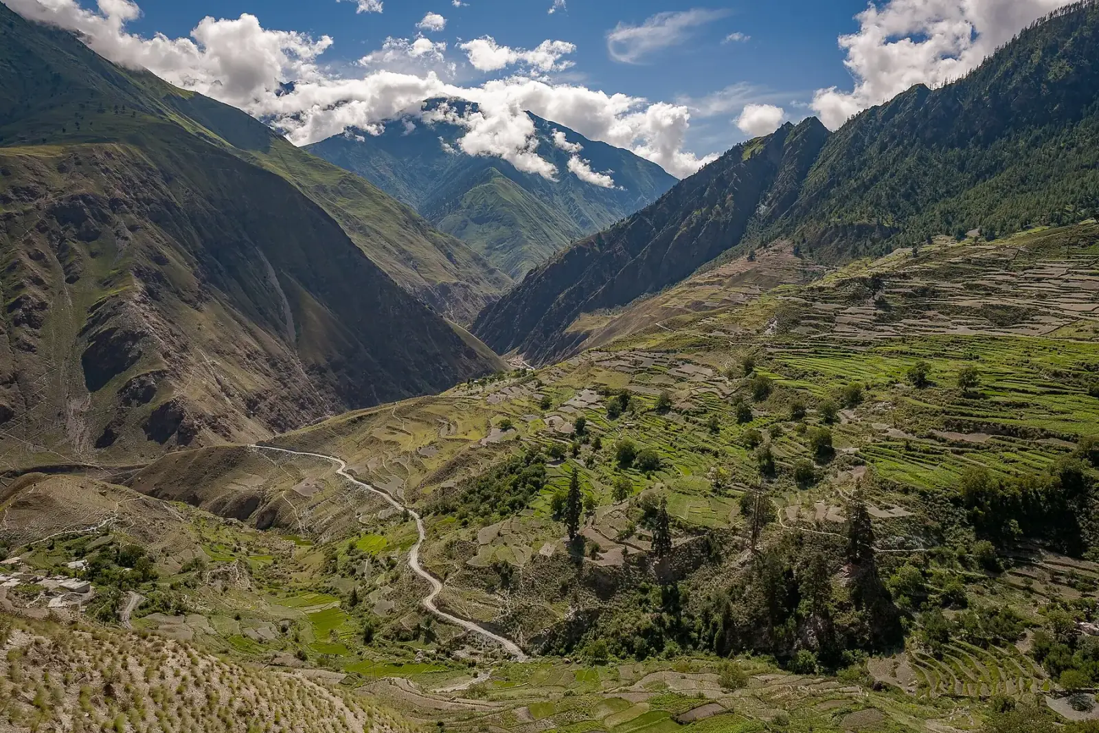
Photo: ::ErWin · CC BY-SA 2.0 · Wikimedia Commons · resized; shared under the same licence
Lower Dolpo / Phoksundo
Nepal's rain-shadow trek — best through the monsoon, not despite it
Lower Dolpo / Phoksundo is an 18-day, hard-rated trek to Ringmo village and Phoksundo Lake (3,612m), Nepal's deepest, crossing two high passes — Numa La (5,309m) and Baga La (5,169m) — between the Tarap valley and the lake. Dolpo sits deep in the Himalaya's rain shadow, so the trek's own best months, June through October, run opposite most of Nepal's trekking calendar. It requires a Lower Dolpo restricted-area permit and Shey Phoksundo National Park entry.
Book Lower Dolpo / Phoksundo
No obligation. Or call +977-9849998031
Route map
Waypoints
- Day 1 — Juphal 2,499 m
- Day 1 — Dunai 2,140 m
- Day 2 — Tarakot 2,540 m
- Day 4 — Nawarpani 3,475 m
- Day 5 — Dho Tarap 4,040 m
- Day 6 — Dho Tarap 4,040 m
- Day 8 — Numa La 5,309 m
- Day 10 — Baga La 5,169 m
- Day 12 — Ringmo 3,640 m
- Day 13 — Ringmo 3,640 m
- Day 13 — Phoksundo Lake 3,612 m
- Day 14 — Chhepka 2,665 m
- Day 15 — Juphal 2,499 m
Map key
- Surveyed trail
- Follows the road — no separate trail mapped
Elevation profile
| Day | Place | Altitude | Gain from previous night |
|---|---|---|---|
| 1 | Dunai | 2,140 m | first night |
| 2 | Tarakot | 2,540 m | +400 m |
| 4 | Nawarpani | 3,475 m | +935 m |
| 5 | Dho Tarap | 4,040 m | +565 m |
| 6 | Dho Tarap | 4,040 m | 0 m |
| 12 | Ringmo | 3,640 m | -400 m |
| 13 | Ringmo | 3,640 m | 0 m |
| 14 | Chhepka | 2,665 m | -975 m |
| 15 | Juphal | 2,499 m | -166 m |
High points on this route that are not sleeping altitudes:
- Numa La (day 8): 5,309 m
- Baga La (day 10): 5,169 m
Terrain elevation interpolated between waypoints by SRTM30m — not the route's sourced altitudes. May read above or below maxAltitude/maxSleepAltitude (both cited, manual figures); render or label accordingly, do not treat as the same number.
Acclimatisation
2 nights on this itinerary gain more than 500 m of sleeping altitude: Nawarpani (+935 m), Dho Tarap (+565 m). 1 of its 2 rest days follow the largest gains. The highest night is 4,040 m.
| Day | Sleeping at | Altitude | Gain from previous night | Rest day |
|---|---|---|---|---|
| 1 | Dunai | 2,140 m | first night | |
| 2 | Tarakot | 2,540 m | +400 m | |
| 4 | Nawarpani | 3,475 m | +935 m (above the 500 m guideline) | |
| 5 | Dho Tarap | 4,040 m | +565 m (above the 500 m guideline) | |
| 6 | Dho Tarap | 4,040 m | 0 m | Rest day — follows the gain above |
| 12 | Ringmo | 3,640 m | -400 m | |
| 13 | Ringmo | 3,640 m | 0 m | Rest day |
| 14 | Chhepka | 2,665 m | -975 m | |
| 15 | Juphal | 2,499 m | -166 m |
Cited to the Wilderness Medical Society Clinical Practice Guidelines (2024): above 3,000 m, do not increase sleeping elevation by more than 500 m per day, and take a rest day every 3–4 days. WMS itself notes that terrain often makes strict adherence impossible.
This is itinerary information, not medical advice, and not clearance to trek. Acclimatisation varies between individuals.
Your trip, day by day — all 18 days, travel included
Every day of the 18-day trip in the order it happens, including the flights, drives and rest days that have no walking stage. These are trip day numbers. The next section numbers walking days instead, starting again at 1, so a day number here and a walking day number there are not the same day.
- Day 1 of 18
Kathmandu — Arrival & Permits
Arrive in Kathmandu for the permit process — Lower Dolpo requires its own restricted-area permit, alongside the Shey Phoksundo National Park entry fee — ahead of the flights into Dolpo.
- Day 2 of 18
Fly to Nepalgunj
The first of two flights, from Kathmandu to Nepalgunj in the Terai lowlands, stages for the short flight into Dolpo the following morning.
- Day 3 of 18
Fly to Juphal (2,499m) — Trek to Dunai (2,140m)
The second flight lands at the Juphal airstrip (2,499m); the trail then continues on foot the same day to Dunai (2,140m), the Dolpa district headquarters on the Thuli Bheri river.
- Day 4 of 18
Dunai to Tarakot (2,540m)
The trail climbs away from the Thuli Bheri to Tarakot (2,540m).
- Day 5 of 18
Tarakot Toward the Tarap Valley
A full day's walk beyond Tarakot, the trail climbs into steeper, more thinly settled ground on the approach to the Tarap valley.
- Day 6 of 18
Onward to Nawarpani (3,475m)
The trail climbs steadily as the valley narrows, reaching Nawarpani (3,475m).
- Day 7 of 18
Nawarpani to Dho Tarap (4,040m)
The trail climbs into the heart of the Tarap valley, reaching Dho Tarap (4,040m), a Bonpo and Buddhist village of 923 people at the last census.
- Day 8 of 18
Acclimatization Day in Dho Tarap (4,040m)
A rest day at Dho Tarap before the two highest passes of the trek, both crossed in the days ahead.
- Day 9 of 18
Dho Tarap Toward Numa La
The trail climbs out of the Tarap valley toward Numa La, gaining height over open, treeless ground.
- Day 10 of 18
Cross Numa La (5,309m)
The first and highest of the trek's two passes, crossed in a single day on a barren, wind-scoured saddle — nobody sleeps at the top.
- Day 11 of 18
Toward Baga La
The trail continues over high ground between the two passes, still above the treeline.
- Day 12 of 18
Cross Baga La (5,169m)
The second of the trek's two high passes, crossed the day after Numa La — again a day crossing rather than an overnight.
- Day 13 of 18
Descent Toward Ringmo
The trail begins its long descent from the passes back toward Phoksundo Lake, dropping steadily as the terrain softens.
- Day 14 of 18
Arrival at Ringmo (3,640m)
The trail reaches Ringmo (3,640m), a Tibetan Bonpo village built on the natural landslide dam that impounds Phoksundo Lake.
- Day 15 of 18
Rest Day at Ringmo — Phoksundo Lake (3,612m)
A day trip from Ringmo to Phoksundo Lake (3,612m), Nepal's deepest, its water a startling turquoise; the return is to Ringmo for a second night.
- Day 16 of 18
Ringmo to Chhepka (2,665m)
The trail descends the Suli Gad valley through the forest of Shey Phoksundo National Park to Chhepka (2,665m).
- Day 17 of 18
Chhepka to Juphal (2,499m)
The final trekking day returns to Juphal (2,499m) and its airstrip.
- Day 18 of 18
Fly to Kathmandu via Nepalgunj — Departure
The return flights retrace the outbound route, via Nepalgunj, back to Kathmandu.
Walking days on the mapped route — 15 days of sourced altitudes
Numbered by walking day: walking day 1 is the first day with a mapped stage. Every altitude below is a waypoint from this route's own sources, listed at the foot of the page.
- Juphal 2,499 m
day stop
Flight from Nepalgunj (itself reached by flight from Kathmandu, not modelled). Altitude from Wikipedia’s Dolpa Airport entry. Not overnighted — the trek continues on foot to Dunai the same day.
- Dunai 2,140 m
overnight
Dolpa district headquarters, on the Thuli Bheri river. OSM exact match, place=suburb.
- Tarakot 2,540 m
overnight
OSM exact match, place=village.
- Nawarpani 3,475 m
overnight
One overnight (variously spelled Laini/Laini Odar in itinerary sources, ~3,375m) between Tarakot and here did not resolve in OSM — no candidate node matched any spelling of the name in the query cache — and is not modelled as a waypoint rather than invent a coordinate for it. Nawarpani itself is an exact OSM match.
- Dho Tarap 4,040 m
overnight
Heart of the Tarap valley; 923 people per the 2011 census (Wikipedia). Published altitude ranges 3,944–4,080m across sources; used 4,040m, the figure given independently by two full day-by-day itineraries (Nepal Eco Trekking’s 16-day and Nepal Gateway Trekking’s 17-day). OSM node has no ele tag.
- Dho Tarap 4,040 m
overnight
Acclimatization day before the two highest passes of the trek.
- Numa La 5,309 m
day stop
Crossed in a day, not slept at. The overnight base camp before it (variously "Numa La Base Camp"/"Numa La BC", ~4,350–4,440m across sources) did not resolve in OSM under any spelling and is not modelled. OSM node "Numala South" (mountain_pass=yes, natural=saddle) carries ele=5309, source:ele=barometer_calibrated_gps — an exact match to the most detailed sourced figure (nepalgatewaytrekking.com: 5,310m). Other sources cite figures as low as 5,159m for "Numa La"; a second, lower OSM saddle 2.7km away ("Numala Baniyan (North)", ele=5160) may correspond to that figure or to an alternate route variant — flagged here rather than silently picking one.
- Baga La 5,169 m
day stop
Crossed the day after Numa La. The overnight camp between the two passes (variously "Danighar"/"Phelung Tang", ~4,080–4,510m across sources) did not resolve in OSM under any spelling and is not modelled, nor did the camp after Baga La before Ringmo (variously "Temche"/"Dajok Tang"/"Yak Kharka", ~3,800–4,080m). OSM node "Bagla Bhaniyan" (mountain_pass=yes, natural=saddle, source:ele=barometer_calibrated_gps) carries ele=5169, matching sherpaexpeditiontrekking.com’s 5,170m almost exactly.
- Ringmo 3,640 m
overnight
Tibetan Bonpo village on the landslide dam that impounds Phoksundo Lake (per Wikipedia, which gives 3,660m — 20m from OSM’s 3,640m, normal spread). This is the overnight stop; Phoksundo Lake itself (next waypoint) is a day visit from here, not a separate camp — confirmed against three independent itinerary sources describing Ringmo as the lodging/camping village and the lake as a same-day walk from it.
- Ringmo 3,640 m
overnight
Rest/exploration day; second night here.
- Phoksundo Lake 3,612 m
day stop
Nepal’s deepest lake (145m), turquoise oligotrophic water; day visit from Ringmo, not slept at. OSM way (natural=water) carries ele=3612, its computed centroid used as the coordinate.
- Chhepka 2,665 m
overnight
Descending the Suli Gad valley back toward Juphal, through Shey Phoksundo National Park forest. OSM exact match, place=hamlet, ele=2665 — an exact match to the published figure.
- Juphal 2,499 m
overnight
Return to the airstrip for the flight out via Nepalgunj to Kathmandu (not modelled as separate waypoints).
The remaining 3 days of this 18-day trip cover travel to and from the trailhead, and buffer time for delays en route — the specifics vary by route.
Permits
| Permit | Fee | Verified |
|---|---|---|
| Lower Dolpo Restricted Area Permit | USD 20 | Verified 2026-09-09 |
| Shey Phoksundo National Park Entry | NPR 3,000 | Verified 2026-09-07 |
Cost breakdown
- Permits (NPR)
- NPR 3,000
- Permits (USD)
- USD 20
Permit fees above are the only figures on this page we have re-verified against the issuing authority; the route's itinerary and altitudes are built from the sources listed further down this page, not independently re-verified with one. Other trip costs — teahouse accommodation, a guide, a porter, and flights where the route requires one — vary by season, operator and party size and are not itemised here.
When to go
Month-by-month fit for Lower Dolpo / Phoksundo, based on this route's own best-months window.
- Jan avoid
- Feb avoid
- Mar avoid
- Apr avoid
- May shoulder
- Jun best
- Jul best
- Aug best
- Sep best
- Oct best
- Nov shoulder
- Dec avoid
Sources
- https://nepalpeakadventure.com/tour/lower-dolpo-trek/
- https://nepalgatewaytrekking.com/trip/lower-dolpo-trek
- https://sherpaexpeditiontrekking.com/package/lower-dolpo-trek
- https://www.nepalecotrekking.com/trip/upper-dolpo-trek
- https://en.wikipedia.org/wiki/Ringmo
- https://en.wikipedia.org/wiki/Dho
- https://en.wikipedia.org/wiki/Dunai,_Nepal
- https://en.wikipedia.org/wiki/Juphal
- https://www.immigration.gov.np/trekking-route-and-permit-fee
Ready to book Lower Dolpo / Phoksundo?
18 days in the Mustang & the far west region, highest night at 4,040 m, from USD 3,500.