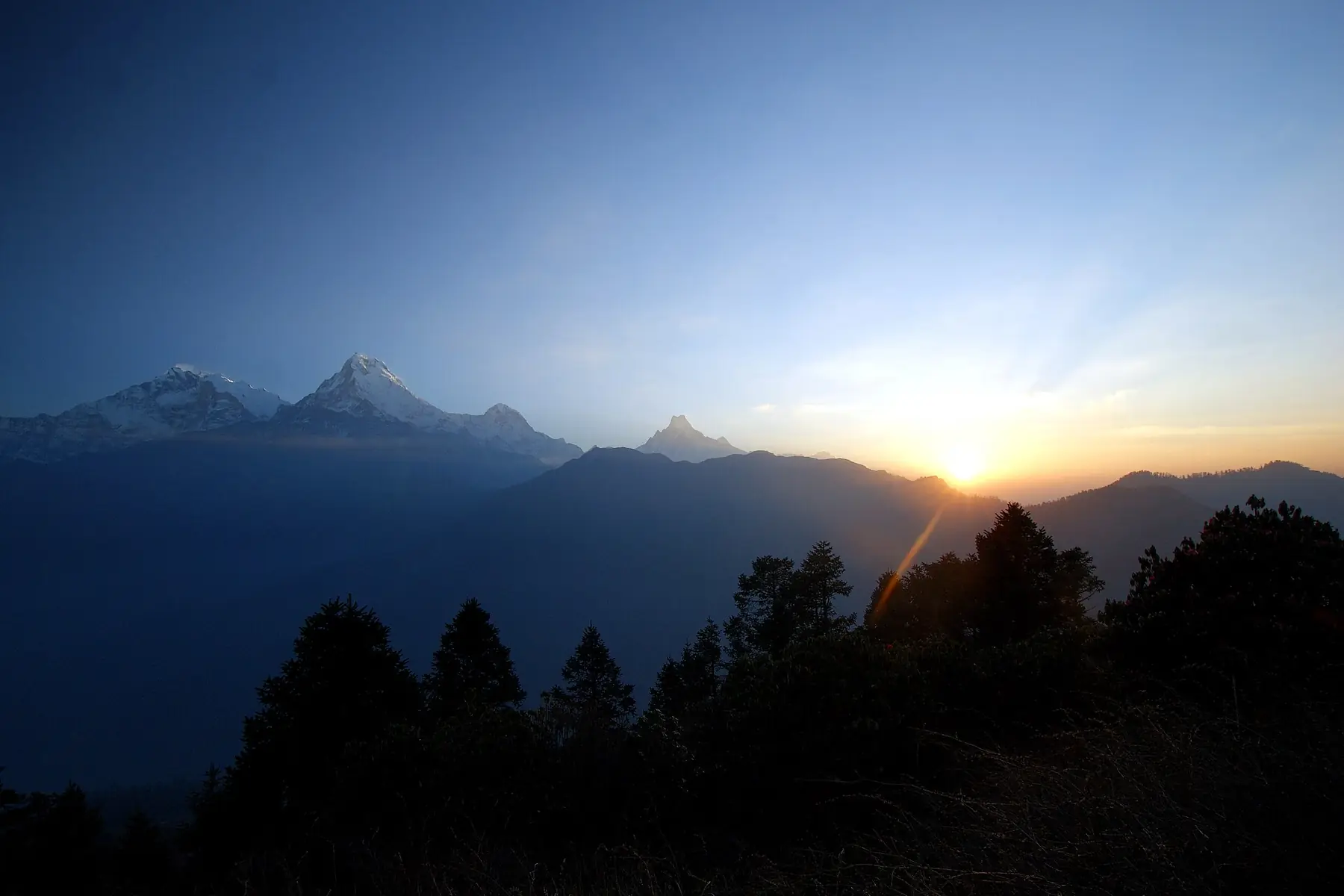
Photo: Kondephy · CC BY-SA 4.0 · Wikimedia Commons · resized; shared under the same licence
Khopra Ridge
Annapurna's high ridge trek to a sacred glacial lake
Khopra Ridge is an 8-day trek in the Annapurna region, climbing above Ghandruk and Tadapani to a high, open ridge at Khopra Ridge (3,660m) with a day hike to the sacred Khayer Lake (4,660m). The final two days share the classic approach to Poon Hill (3,210m) before descending to the roadhead at Birethanti.
Book Khopra Ridge
No obligation. Or call +977-9849998031
Route map
Waypoints
- Day 1 — Ghandruk 1,940 m
- Day 2 — Tadapani 2,610 m
- Day 3 — Dobato 3,350 m
- Day 4 — Khopra Ridge 3,660 m
- Day 5 — Khayer Lake 4,660 m
- Day 5 — Khopra Ridge 3,660 m
- Day 6 — Swanta 2,270 m
- Day 7 — Ghorepani 2,850 m
- Day 8 — Poon Hill 3,210 m
- Day 8 — Birethanti 1,025 m
Map key
- Surveyed trail
- Follows the road — no separate trail mapped
Elevation profile
| Day | Place | Altitude | Gain from previous night |
|---|---|---|---|
| 1 | Ghandruk | 1,940 m | first night |
| 2 | Tadapani | 2,610 m | +670 m |
| 3 | Dobato | 3,350 m | +740 m |
| 4 | Khopra Ridge | 3,660 m | +310 m |
| 5 | Khopra Ridge | 3,660 m | 0 m |
| 6 | Swanta | 2,270 m | -1,390 m |
| 7 | Ghorepani | 2,850 m | +580 m |
| 8 | Birethanti | 1,025 m | -1,825 m |
Terrain elevation interpolated between waypoints by SRTM30m — not the route's sourced altitudes. May read above or below maxAltitude/maxSleepAltitude (both cited, manual figures); render or label accordingly, do not treat as the same number.
Acclimatisation
1 night on this itinerary gains more than 500 m of sleeping altitude: Dobato (+740 m). 0 of its 1 rest days follow the largest gains. The highest night is 3,660 m.
| Day | Sleeping at | Altitude | Gain from previous night | Rest day |
|---|---|---|---|---|
| 1 | Ghandruk | 1,940 m | first night | |
| 2 | Tadapani | 2,610 m | +670 m | |
| 3 | Dobato | 3,350 m | +740 m (above the 500 m guideline) | |
| 4 | Khopra Ridge | 3,660 m | +310 m | |
| 5 | Khopra Ridge | 3,660 m | 0 m | Rest day |
| 6 | Swanta | 2,270 m | -1,390 m | |
| 7 | Ghorepani | 2,850 m | +580 m | |
| 8 | Birethanti | 1,025 m | -1,825 m |
Cited to the Wilderness Medical Society Clinical Practice Guidelines (2024): above 3,000 m, do not increase sleeping elevation by more than 500 m per day, and take a rest day every 3–4 days. WMS itself notes that terrain often makes strict adherence impossible.
This is itinerary information, not medical advice, and not clearance to trek. Acclimatisation varies between individuals.
Your trip, day by day — all 8 days, travel included
Every day of the 8-day trip in the order it happens, including the flights, drives and rest days that have no walking stage. These are trip day numbers. The next section numbers walking days instead, starting again at 1, so a day number here and a walking day number there are not the same day.
- Day 1 of 8
Drive to Nayapul — Trek to Ghandruk (1,940m)
Drive from Pokhara to Nayapul, then follow the trail through Birethanti into Gurung country. Stone-paved lanes and terraced fields climb steadily to Ghandruk (1,940m), one of the larger Gurung villages in the Annapurna foothills.
- Day 2 of 8
Ghandruk to Tadapani (2,610m)
The trail climbs through rhododendron and oak forest above Ghandruk, gaining height steadily to Tadapani (2,610m), a ridge-top stop with views back across the valley toward Annapurna South (7,219m).
- Day 3 of 8
Tadapani to Dobato (3,350m)
Above the rhododendron line, the trail opens onto ridge country, passing near the Muldai viewpoint and the high pasture at Bayeli Kharka before reaching Dobato (3,350m), a junction stop where the Khopra trail parts from the wider Annapurna Sanctuary circuit.
- Day 4 of 8
Dobato to Khopra Ridge (3,660m)
Continue along the open ridge, above the treeline, to Khopra Ridge (3,660m) — also known as Khopra Danda — a broad shoulder with unobstructed views across the Annapurna Sanctuary's southern rim toward Dhaulagiri (8,167m) and Annapurna South (7,219m).
- Day 5 of 8
Day Hike to Khayer Lake (4,660m) — Return to Khopra Ridge (3,660m)
A long out-and-back day to Khayer Lake (4,660m), a sacred alpine lake set below the ridge in bare rock and scree well above the last vegetation. The trail returns the same way to Khopra Ridge (3,660m) for a second night.
- Day 6 of 8
Descend to Swanta (2,270m)
Leave the ridge and drop back down through Chitre and Phalante, re-entering forest and terraced farmland at Swanta (2,270m).
- Day 7 of 8
Swanta to Ghorepani (2,850m)
Climb back up through forest to Ghorepani (2,850m), a village built around the trail junction below Poon Hill, where trekkers moving between the Sanctuary and the wider Annapurna circuit converge.
- Day 8 of 8
Poon Hill Sunrise (3,210m) — Descend to Birethanti (1,025m)
A pre-dawn climb to Poon Hill (3,210m) for a last wide panorama, then the long descent through Ulleri's stone staircase and Tikhedhunga to Birethanti (1,025m), the roadhead near Nayapul for the drive back to Pokhara.
Walking days on the mapped route — 8 days of sourced altitudes
Numbered by walking day: walking day 1 is the first day with a mapped stage. Every altitude below is a waypoint from this route's own sources, listed at the foot of the page.
- Ghandruk 1,940 m
overnight
Drive Pokhara-Nayapul, trek via Birethanti.
- Tadapani 2,610 m overnight
- Dobato 3,350 m
overnight
Junction stop near Muldai viewpoint (3,637m). Some operators use the name "Bayeli Kharka" (~3,420m, not separately resolved in OSM) for a stop in the same stretch.
- Khopra Ridge 3,660 m
overnight
Also called Khopra Danda. OSM node name itself carries "3600m", corroborating the published figure.
- Khayer Lake 4,660 m
day stop
Day trip from Khopra Ridge, 8-10 hours round trip. A sacred lake, not an overnight stop.
- Khopra Ridge 3,660 m
overnight
Same-day return from Khayer Lake.
- Swanta 2,270 m
overnight
Descent via Chitre and Phalante.
- Ghorepani 2,850 m overnight
- Poon Hill 3,210 m
day stop
Pre-dawn detour on the way out.
- Birethanti 1,025 m
overnight
Descend via Tikhedhunga and Ulleri. Roadhead near Nayapul, jeep/bus to Pokhara.
Permits
| Permit | Fee | Verified |
|---|---|---|
| Annapurna Conservation Area Permit | NPR 3,000 | Verified 2026-09-07 |
Cost breakdown
- Permits (NPR)
- NPR 3,000
Permit fees above are the only figures on this page we have re-verified against the issuing authority; the route's itinerary and altitudes are built from the sources listed further down this page, not independently re-verified with one. Other trip costs — teahouse accommodation, a guide, a porter, and flights where the route requires one — vary by season, operator and party size and are not itemised here.
When to go
Month-by-month fit for Khopra Ridge, based on this route's own best-months window.
- Jan avoid
- Feb shoulder
- Mar best
- Apr best
- May best
- Jun shoulder
- Jul avoid
- Aug shoulder
- Sep best
- Oct best
- Nov best
- Dec shoulder
Sources
Ready to book Khopra Ridge?
8 days in the Annapurna region, highest night at 3,660 m, from USD 650.