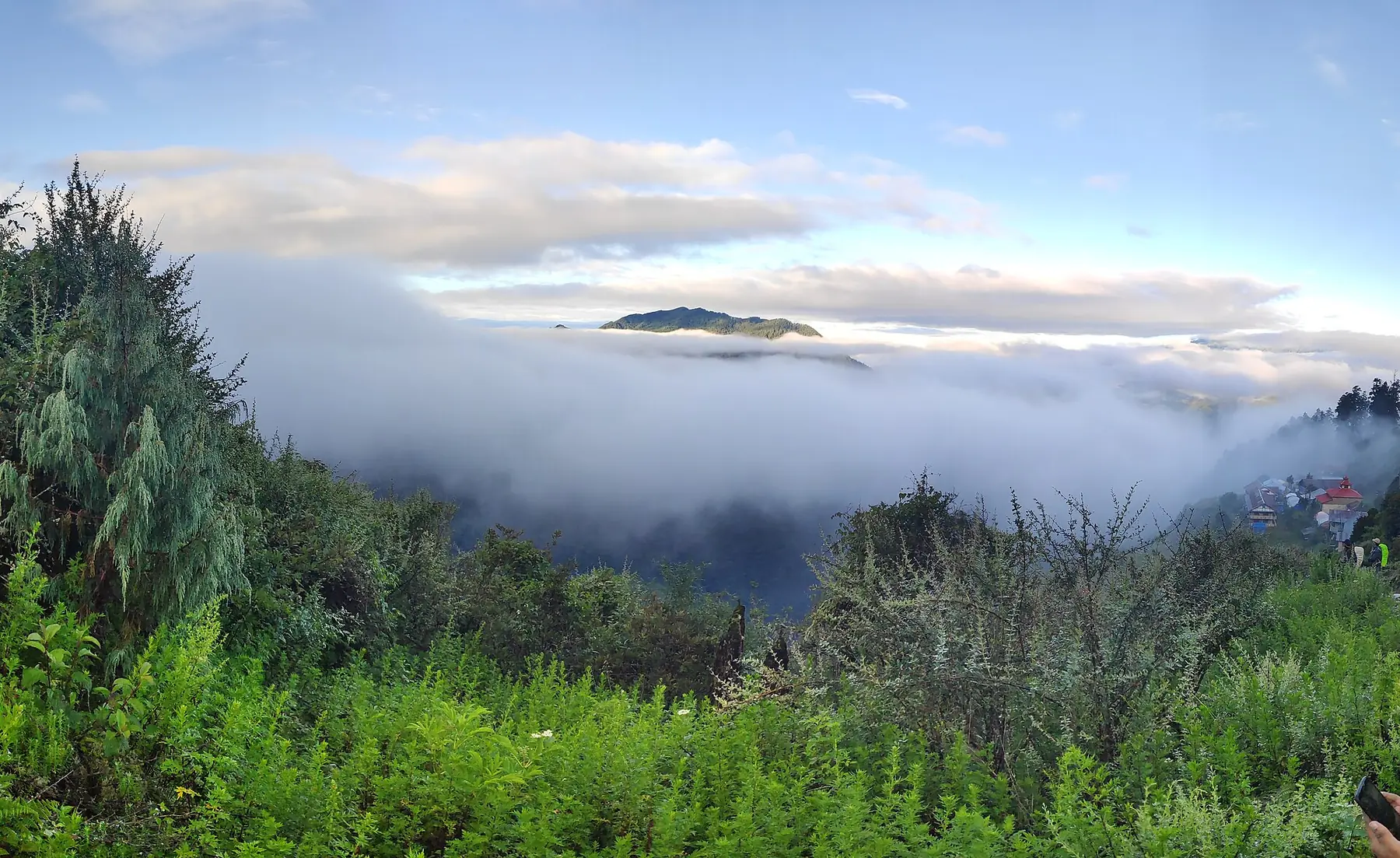
Photo: Hari Paudyel · CC BY-SA 4.0 · Wikimedia Commons · resized; shared under the same licence
Gosaikunda
An out-and-back climb to Langtang's sacred alpine lake
Gosaikunda is an 8-day out-and-back trek from Syabrubesi to the sacred alpine lake of the same name (4,380m), climbing directly up the Langtang region's western side through Thulo Syabru and Chandanbari rather than via the Langtang Valley. The route returns the way it came rather than continuing over Laurebina La to Helambu, which is a separate, longer combined trek.
Book Gosaikunda
No obligation. Or call +977-9849998031
Route map
Waypoints
- Day 1 — Syabrubesi 1,460 m
- Day 2 — Thulo Syabru 2,250 m
- Day 3 — Chandanbari 3,330 m
- Day 4 — Gosaikunda 4,380 m
- Day 5 — Gosaikunda 4,380 m
- Day 6 — Chandanbari 3,330 m
- Day 7 — Thulo Syabru 2,250 m
- Day 8 — Syabrubesi 1,460 m
Elevation profile
| Day | Place | Altitude | Gain from previous night |
|---|---|---|---|
| 1 | Syabrubesi | 1,460 m | first night |
| 2 | Thulo Syabru | 2,250 m | +790 m |
| 3 | Chandanbari | 3,330 m | +1,080 m |
| 4 | Gosaikunda | 4,380 m | +1,050 m |
| 5 | Gosaikunda | 4,380 m | 0 m |
| 6 | Chandanbari | 3,330 m | -1,050 m |
| 7 | Thulo Syabru | 2,250 m | -1,080 m |
| 8 | Syabrubesi | 1,460 m | -790 m |
Terrain elevation interpolated between waypoints by SRTM30m — not the route's sourced altitudes. May read above or below maxAltitude/maxSleepAltitude (both cited, manual figures); render or label accordingly, do not treat as the same number.
Acclimatisation
2 nights on this itinerary gain more than 500 m of sleeping altitude: Chandanbari (+1080 m), Gosaikunda (+1050 m). Each of its 1 rest day follows the gain that earned it. The highest night is 4,380 m.
| Day | Sleeping at | Altitude | Gain from previous night | Rest day |
|---|---|---|---|---|
| 1 | Syabrubesi | 1,460 m | first night | |
| 2 | Thulo Syabru | 2,250 m | +790 m | |
| 3 | Chandanbari | 3,330 m | +1,080 m (above the 500 m guideline) | |
| 4 | Gosaikunda | 4,380 m | +1,050 m (above the 500 m guideline) | |
| 5 | Gosaikunda | 4,380 m | 0 m | Rest day — follows the gain above |
| 6 | Chandanbari | 3,330 m | -1,050 m | |
| 7 | Thulo Syabru | 2,250 m | -1,080 m | |
| 8 | Syabrubesi | 1,460 m | -790 m |
Cited to the Wilderness Medical Society Clinical Practice Guidelines (2024): above 3,000 m, do not increase sleeping elevation by more than 500 m per day, and take a rest day every 3–4 days. WMS itself notes that terrain often makes strict adherence impossible.
This is itinerary information, not medical advice, and not clearance to trek. Acclimatisation varies between individuals.
Your trip, day by day — all 8 days, travel included
Every day of the 8-day trip in the order it happens, including the flights, drives and rest days that have no walking stage. These are trip day numbers. The next section numbers walking days instead, starting again at 1, so a day number here and a walking day number there are not the same day.
- Day 1 of 8
Kathmandu to Syabrubesi (1,460m)
The drive from Kathmandu follows the Trisuli River to Syabrubesi (1,460m), the roadhead for the whole Langtang region.
- Day 2 of 8
Syabrubesi to Thulo Syabru (2,250m)
The trail climbs directly south out of Syabrubesi toward Thulo Syabru (2,250m) — a different route from the one that heads east via Lama Hotel into the Langtang Valley.
- Day 3 of 8
Thulo Syabru to Chandanbari (3,330m)
Continue climbing through forest to Chandanbari (3,330m), also known as Shin Gompa.
- Day 4 of 8
Chandanbari to Gosaikunda (4,380m)
A steep climb of over 1,000m brings the trail above the treeline to Gosaikunda (4,380m), a sacred alpine lake held in a bowl of bare rock and scree.
- Day 5 of 8
Acclimatization Day at Gosaikunda (4,380m)
A rest day at the lake before descending. A short excursion climbs to a viewpoint above the lake for a wider look at the surrounding ridgeline.
- Day 6 of 8
Descend to Chandanbari (3,330m)
Retrace the ascent route back down to Chandanbari (3,330m).
- Day 7 of 8
Descend to Thulo Syabru (2,250m)
Continue the descent to Thulo Syabru (2,250m).
- Day 8 of 8
Thulo Syabru to Syabrubesi (1,460m)
The final descent returns to Syabrubesi (1,460m), closing the loop without crossing Laurebina La — that crossing belongs to the longer Gosaikunda-Helambu combined route.
Walking days on the mapped route — 8 days of sourced altitudes
Numbered by walking day: walking day 1 is the first day with a mapped stage. Every altitude below is a waypoint from this route's own sources, listed at the foot of the page.
- Syabrubesi 1,460 m
overnight
7-9h drive from Kathmandu; the roadhead for the whole Langtang region.
- Thulo Syabru 2,250 m
overnight
The direct southward trail toward Gosaikunda branches from Syabrubesi here — a different trail from the Langtang Valley route east via Lama Hotel.
- Chandanbari 3,330 m
overnight
Also called Shin Gompa. OSM ele=3300 (delta 30m from the published 3,330m).
- Gosaikunda 4,380 m
overnight
Sacred alpine lake, 4,380m per Wikipedia. The OSM hamlet node at the lakeside lodges (601521345) carries ele=4430 (delta 50m), corroborating the published figure.
- Gosaikunda 4,380 m
overnight
Acclimatization day at the lake before descending — over 1,000m of gain from Chandanbari the day before. A short (1.25km/~1h, 195m gain) 'Gosainkunda viewpoint' excursion above the lake is reached on this acclimatization day, sourced at 4,613m by this route's own goingthewholehogg.com source (elevation-profile table entry: 'GOSAINKUNDA VIEWPOINT (4613 m) | 1.25 km / 1 hour | 195 m | 195 m') — this is where maxAltitude (4,613m) comes from. Deliberately NOT modelled as a separate waypoint, and there is no waypoint at 4,613m in this route's list: checked the Langtang OSM cache and two further live Overpass queries (name search for Gosaikunda/Gosainkunda variants; a 2km radius search for every tourism=viewpoint/natural=peak/natural=saddle node) and found no candidate that is both a plausible name match and elevation/distance-consistent with the source's 4,613m/1.25km profile — the nearest tourism=viewpoint node ('Lake viewpoint', 0.34km away) carries no elevation tag and fails this project's name-plausibility bar, and the nearest peak with a real name and elevation (Cholangpatidanda, 4,788m, 0.79km) is a documented distinct feature used elsewhere. The altitude is sourced and real; only the coordinate is unavailable — those are separable (see schema.ts: maxAltitude must be >= the highest listed waypoint, not equal to one, precisely so a real high point without a plottable waypoint can still be published honestly). Please don't 'reconcile' maxAltitude back down to 4,380m to match the waypoint list — the gap between them is the point.
- Chandanbari 3,330 m
overnight
Descend, retracing the ascent route.
- Thulo Syabru 2,250 m
overnight
Descend.
- Syabrubesi 1,460 m
overnight
End of trek. This route does not cross Laurebina La — that crossing belongs to the Gosaikunda-Helambu combined route.
Permits
| Permit | Fee | Verified |
|---|---|---|
| Langtang National Park Entry | NPR 3,000 | Verified 2026-09-07 |
| Trekkers' Information Management System card | NPR 2,000 | Verified 2026-09-07 |
Trekkers' Information Management System card: TAAN publishes a further breakdown by trekker type: Blue (group) TIMS NPR 1,000, Green (individual/FIT) TIMS NPR 2,000, SAARC group NPR 300, SAARC FIT NPR 600 — see https://www.taan.org.np/page/about-tims. Applicability in the Everest and Annapurna regions is contested as of the verifiedOn date. NTB's own TIMS page (this source) and TAAN's own TIMS page (https://www.taan.org.np/page/about-tims) both still list Everest and Annapurna trek routes as requiring TIMS, under a provision dated effective March 31, 2023, with no visible update since. Current operator practice, reported consistently across 2026-dated trekking-agency sites, describes TIMS as discontinued in Everest (replaced by the Khumbu Pasang Lhamu Rural Municipality Trek-Card) and no longer enforced on standard Annapurna routes, with checkpoints there said to verify only the conservation-area permit. We could not find a primary NTB, TAAN or DNPWC circular confirming that change, so neither position is asserted here.
Cost breakdown
- Permits (NPR)
- NPR 5,000
Permit fees above are the only figures on this page we have re-verified against the issuing authority; the route's itinerary and altitudes are built from the sources listed further down this page, not independently re-verified with one. Other trip costs — teahouse accommodation, a guide, a porter, and flights where the route requires one — vary by season, operator and party size and are not itemised here.
When to go
Month-by-month fit for Gosaikunda, based on this route's own best-months window.
- Jan avoid
- Feb shoulder
- Mar best
- Apr best
- May best
- Jun shoulder
- Jul avoid
- Aug avoid
- Sep shoulder
- Oct best
- Nov best
- Dec shoulder
Sources
Ready to book Gosaikunda?
8 days in the Langtang region, highest night at 4,380 m, from USD 780.