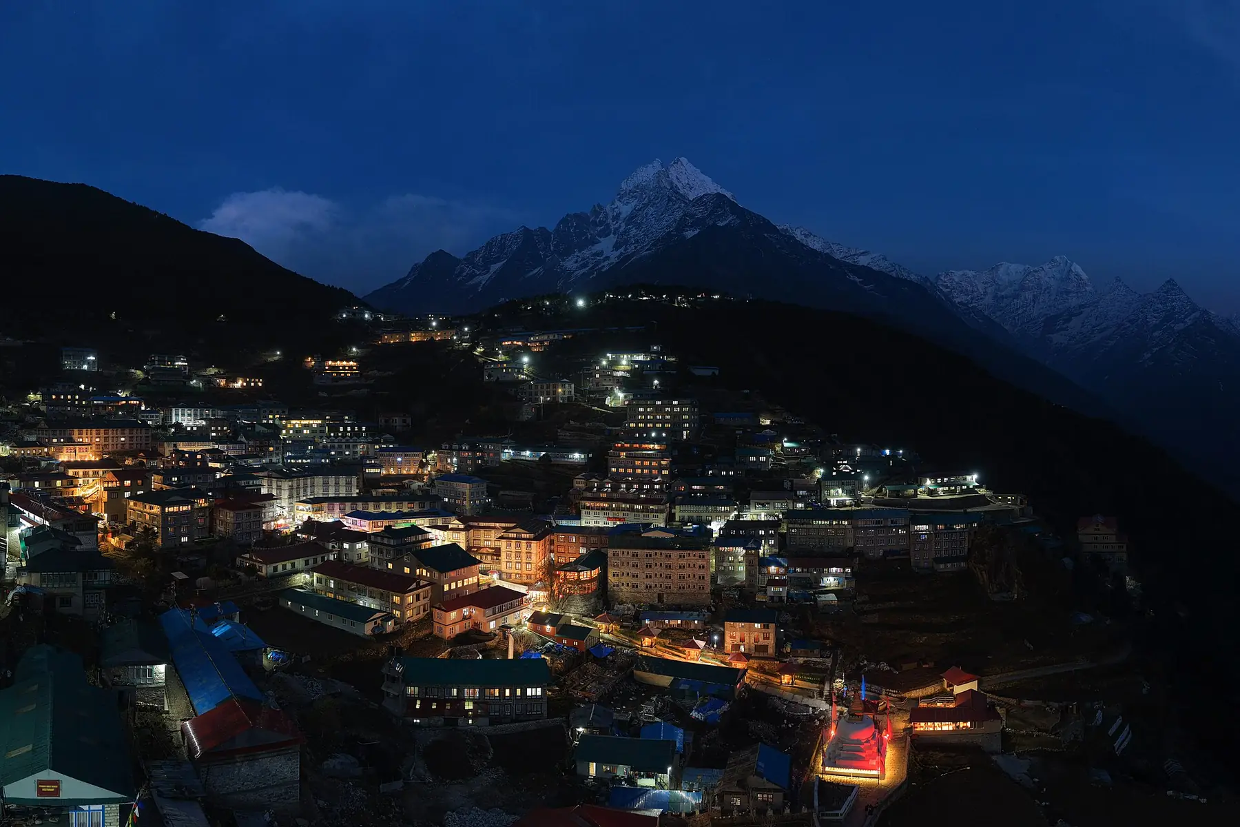
Photo: Megaurab09 · CC BY-SA 4.0 · Wikimedia Commons · resized; shared under the same licence
Gokyo Lakes
Alpine lakes, glacier views and a Gokyo Ri sunset.
Gokyo Lakes trades Everest Base Camp's altitude and crowds for a chain of glacial lakes and a single big-view summit. Over twelve days the trail leaves the main Everest Base Camp route at Ḍole and follows the Dudh Kosi valley north to Gokyo (4,750m), on the shore of Dudh Pokhari, the third of the Gokyo lakes, below the Ngozumpa Glacier — the largest glacier in Nepal. A climb up Gokyo Ri (5,357m) is the trip's high point, with views across four of the region's 8,000m peaks: Everest, Lhotse, Makalu and Cho Oyu.
Book Gokyo Lakes
No obligation. Or call +977-9849998031
Route map
Waypoints
- Day 1 — Lukla 2,840 m
- Day 1 — Phakding 2,610 m
- Day 2 — Namche Bazaar 3,440 m
- Day 3 — Namche Bazaar 3,440 m
- Day 4 — Ḍole 4,038 m
- Day 5 — Macchermo 4,470 m
- Day 6 — Gokyo 4,750 m
- Day 6 — Gokyo Ri 5,357 m
- Day 7 — Macchermo 4,470 m
- Day 8 — Namche Bazaar 3,440 m
- Day 9 — Lukla 2,840 m
Elevation profile
| Day | Place | Altitude | Gain from previous night |
|---|---|---|---|
| 1 | Lukla | 2,840 m | first night |
| 1 | Phakding | 2,610 m | -230 m |
| 2 | Namche Bazaar | 3,440 m | +830 m |
| 3 | Namche Bazaar | 3,440 m | 0 m |
| 4 | Ḍole | 4,038 m | +598 m |
| 5 | Macchermo | 4,470 m | +432 m |
| 6 | Gokyo | 4,750 m | +280 m |
| 7 | Macchermo | 4,470 m | -280 m |
| 8 | Namche Bazaar | 3,440 m | -1,030 m |
| 9 | Lukla | 2,840 m | -600 m |
Terrain elevation interpolated between waypoints by SRTM30m — not the route's sourced altitudes. May read above or below maxAltitude/maxSleepAltitude (both cited, manual figures); render or label accordingly, do not treat as the same number.
Acclimatisation
2 nights on this itinerary gain more than 500 m of sleeping altitude: Namche Bazaar (+830 m), Ḍole (+598 m). Each of its 1 rest day follows the gain that earned it. The highest night is 4,750 m.
| Day | Sleeping at | Altitude | Gain from previous night | Rest day |
|---|---|---|---|---|
| 1 | Lukla | 2,840 m | first night | |
| 1 | Phakding | 2,610 m | -230 m | |
| 2 | Namche Bazaar | 3,440 m | +830 m (above the 500 m guideline) | |
| 3 | Namche Bazaar | 3,440 m | 0 m | Rest day — follows the gain above |
| 4 | Ḍole | 4,038 m | +598 m (above the 500 m guideline) | |
| 5 | Macchermo | 4,470 m | +432 m | |
| 6 | Gokyo | 4,750 m | +280 m | |
| 7 | Macchermo | 4,470 m | -280 m | |
| 8 | Namche Bazaar | 3,440 m | -1,030 m | |
| 9 | Lukla | 2,840 m | -600 m |
Cited to the Wilderness Medical Society Clinical Practice Guidelines (2024): above 3,000 m, do not increase sleeping elevation by more than 500 m per day, and take a rest day every 3–4 days. WMS itself notes that terrain often makes strict adherence impossible.
This is itinerary information, not medical advice, and not clearance to trek. Acclimatisation varies between individuals.
Your trip, day by day — all 12 days, travel included
Every day of the 12-day trip in the order it happens, including the flights, drives and rest days that have no walking stage. These are trip day numbers. The next section numbers walking days instead, starting again at 1, so a day number here and a walking day number there are not the same day.
- Day 1 of 12
Fly to Lukla — Trek to Phakding (2,610m)
The flight from Kathmandu lands at Lukla (2,840m); the trail then drops through pine forest along the Dudh Kosi to Phakding for the first night — a net descent, though the trail itself rises and falls along the way.
- Day 2 of 12
Phakding to Namche Bazaar (3,440m)
The trail climbs steadily above the confluence of the Dudh Kosi and Bhote Kosi rivers to Namche Bazaar, the Khumbu's trading hub, built into a natural amphitheater on the hillside — an 830m gain over the day.
- Day 3 of 12
Acclimatization Day in Namche Bazaar
A rest day before the trail leaves the main Everest corridor. The optional add-on is a side trip to Khumjung, a Sherpa village on the ridge above Namche, before a second night back in Namche.
- Day 4 of 12
Namche Bazaar to Ḍole (4,038m)
The trail forks away from the main Everest Base Camp route here, leaving the Khumbu's busiest corridor for the quieter Gokyo (Dudh Kosi) valley. Forest gives way to open, wind-scoured slopes as the trail gains height toward Ḍole.
- Day 5 of 12
Ḍole to Macchermo (4,470m)
The valley opens further as the trail climbs above the treeline, following the Dudh Kosi toward its glacial source. Macchermo sits just below the terminal moraine of the Ngozumpa Glacier, in bare, rocky terrain typical of the upper Gokyo valley.
- Day 6 of 12
Macchermo to Gokyo (4,750m) — Climb Gokyo Ri (5,357m)
A short walk up the valley along the edge of the Ngozumpa Glacier reaches Gokyo, strung along the shore of Dudh Pokhari, the third of the Gokyo lakes. In the afternoon, the climb up Gokyo Ri rewards with a view across four 8,000m peaks — Everest, Lhotse, Makalu and Cho Oyu — before the descent back to Gokyo for the night.
- Day 7 of 12
Morning at the Fourth Lake — Descend to Macchermo (4,470m)
A morning walk visits the fourth of the Gokyo lakes before the trail turns back down the valley, retracing the previous days' route to Macchermo.
- Day 8 of 12
Macchermo to Namche Bazaar (3,440m)
The return route retraces the Gokyo valley down through Dole and Phortse Tenga before rejoining the main Everest trail back into Namche Bazaar.
- Day 9 of 12
Namche Bazaar to Lukla (2,840m)
The final trekking day descends back through forest to Lukla, closing the loop at the same airstrip the trip began from nine days earlier.
- Day 10 of 12
First Reserve Day for the Return Flight
Lukla flights are delayed often enough that this itinerary holds two days in reserve rather than one. Day 10 is the earliest the return flight might go.
- Day 11 of 12
Second Reserve Day
Used only if day 10's flight did not go. Otherwise this is unclaimed time, either still in Lukla or already back in Kathmandu.
- Day 12 of 12
Departure
By the second reserve day the flight has gone out, whichever day it landed on, and day 12 is departure from Kathmandu.
Walking days on the mapped route — 9 days of sourced altitudes
Numbered by walking day: walking day 1 is the first day with a mapped stage. Every altitude below is a waypoint from this route's own sources, listed at the foot of the page.
- Lukla 2,840 m
overnight
Tenzing–Hillary airstrip.
- Phakding 2,610 m
overnight
Net descent on day one.
- Namche Bazaar 3,440 m
overnight
830 m gain.
- Namche Bazaar 3,440 m
overnight
Acclimatization day; optional side trip to Khumjung.
- Ḍole 4,038 m
overnight
Leaves the main EBC trail for the Gokyo (Dudh Kosi) valley.
- Macchermo 4,470 m
overnight
Below the terminal moraine of the Ngozumpa Glacier.
- Gokyo 4,750 m
overnight
On the shore of Dudh Pokhari, the third Gokyo lake.
- Gokyo Ri 5,357 m
day stop
Afternoon climb for sunset views over Everest, Lhotse, Makalu and Cho Oyu. Nobody sleeps at the summit.
- Macchermo 4,470 m
overnight
Morning visit to the fourth lake, then descent begins.
- Namche Bazaar 3,440 m
overnight
Return via Dole and Phortse Tenga.
- Lukla 2,840 m
overnight
Buffer days 10–12 absorb flight delays, which are common.
The remaining 3 days of this 12-day trip cover travel to and from the trailhead, and buffer time for delays en route — the specifics vary by route.
Permits
| Permit | Fee | Verified |
|---|---|---|
| Sagarmatha National Park Entry | NPR 3,000 | Verified 2026-09-07 |
| Khumbu Pasang Lhamu Rural Municipality Fee | NPR 3,000 | Verified 2026-09-07 |
Cost breakdown
- Permits (NPR)
- NPR 6,000
Permit fees above are the only figures on this page we have re-verified against the issuing authority; the route's itinerary and altitudes are built from the sources listed further down this page, not independently re-verified with one. Other trip costs — teahouse accommodation, a guide, a porter, and flights where the route requires one — vary by season, operator and party size and are not itemised here.
When to go
Month-by-month fit for Gokyo Lakes, based on this route's own best-months window.
- Jan avoid
- Feb shoulder
- Mar best
- Apr best
- May best
- Jun shoulder
- Jul avoid
- Aug avoid
- Sep shoulder
- Oct best
- Nov best
- Dec shoulder
Sources
Ready to book Gokyo Lakes?
12 days in the Everest (Khumbu) region, highest night at 4,750 m, from USD 1,050.